A Polar Day Hike In The Brooks Range


The term midnight sun refers to the polar phenomenon where the sun doesn't fully set below the horizon on and around the summer solstice. However, "midnight sun" is often informally used when describing the long daylight hours and twilit nights experienced by areas of Alaska where true midnight sun does not actually occur, which includes most of Alaska's population centers and major tourist destinations. That's why I prefer the less ambiguous term polar day when referring to the 24/7 daylight experienced by the Arctic. 

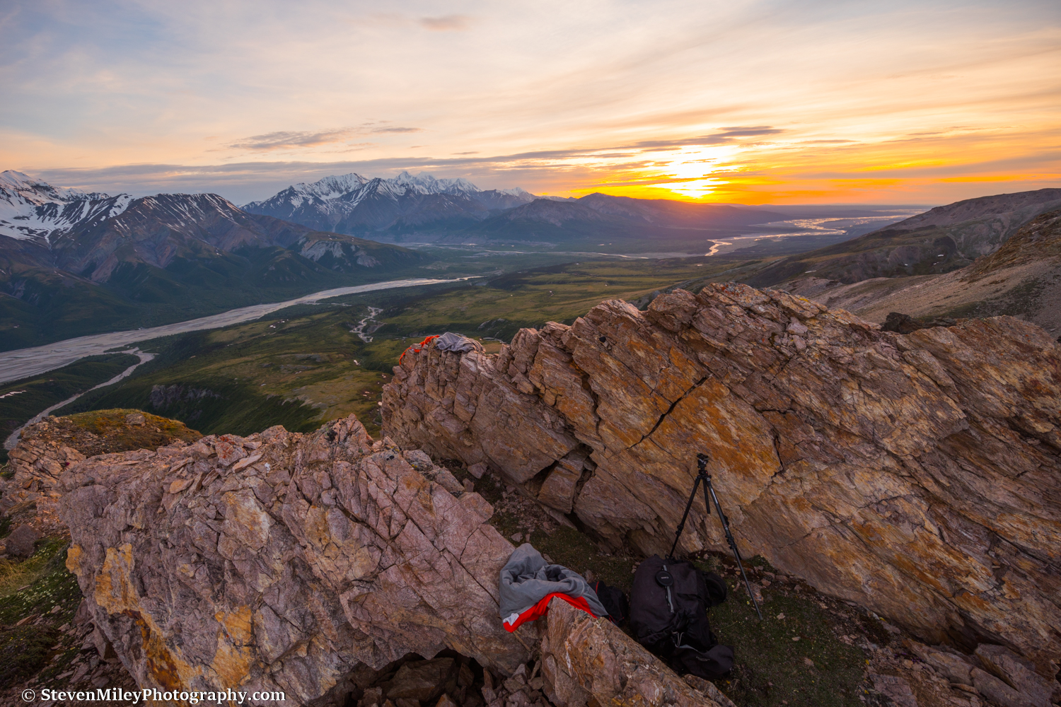
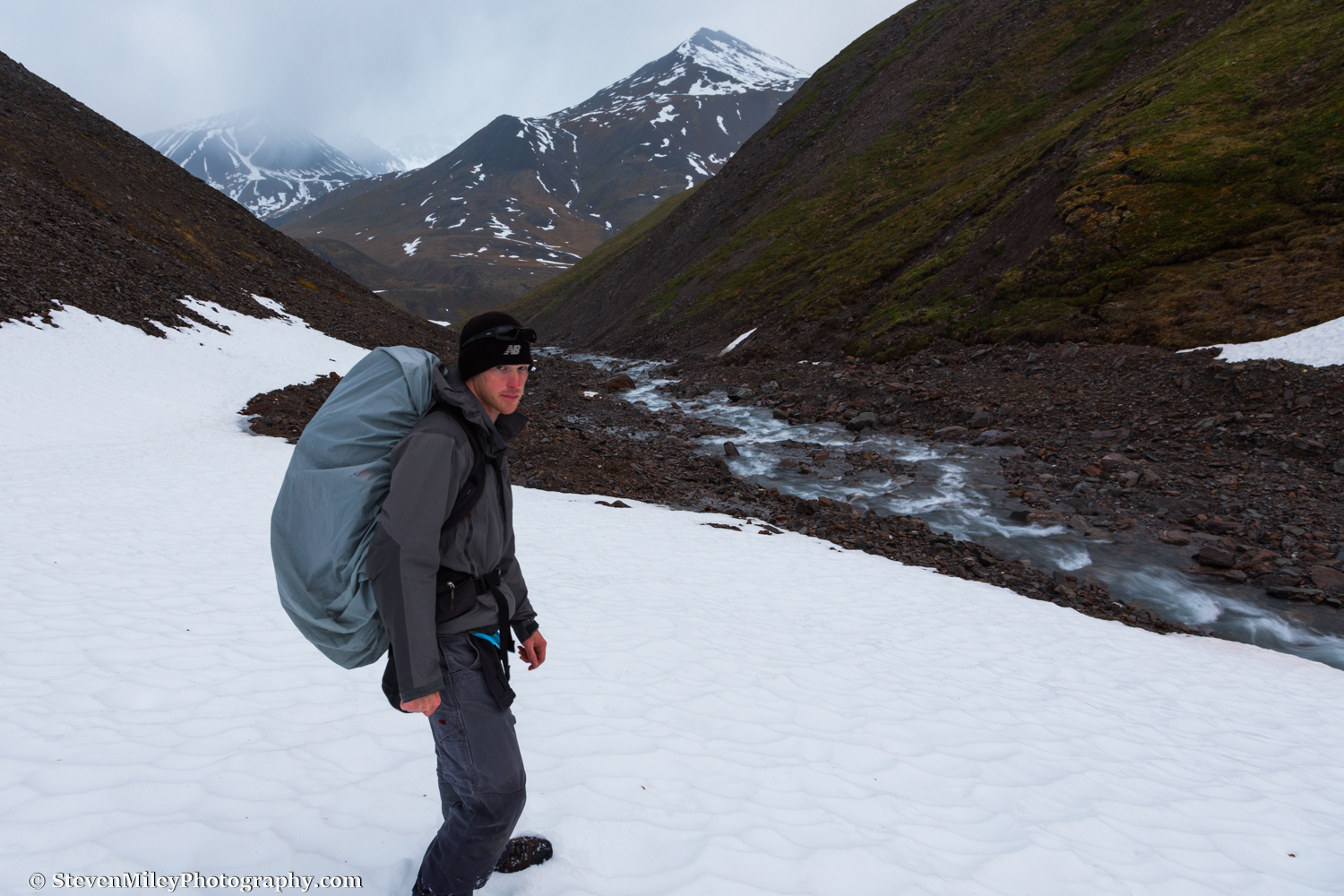
Hiking only during traditional waking hours is a sad waste of polar day. This goes double for photographers since the light is better when the sun is flirting with the horizon. So, on an excursion above the Arctic Circle following the recent summer solstice, I decided to go for a day hike in Alaska's Brooks Range at 'night'. I started my hike shortly before 9 p.m., ascending through a valley immediately west of the Dalton Highway just south of Atigun Pass. A clear-running creek flowed through the valley, fed by dozens of smaller streams cascading down the surrounding mountains. 

9:58 P.M. - A mile or two west of the Dalton Highway.

9:58 P.M. - A mile or two west of the Dalton Highway.

I had traveled only a short distance when I saw footprints in the creek bed. They appeared to be less than a day old and left by a single person. Without the footprints, it would have been tough to tell anyone had ever been there: there was no social trail, no litter, no cairns, and no fire pits—not that there was any wood to burn in the treeless tundra.   

After a few miles of easy hiking, I reached the base of a pass. At that moment, the clouds lowered over the mountain peaks around me and steady rain began falling. I tightened the hood of my rain jacket and began ascending the steep scree slope. After the slope lessened, the rain trailed off and the sky began to clear. The peaks of the mountains reemerged from the clouds with a dusting of fresh snow. The clock had struck midnight already and the clouds were beginning to glow with sunset hues, while the sun itself had disappeared behind the mountain on my right.

12:17 A.M. - Stopping for rest at a small pond on the way over the pass.

12:17 A.M. - Stopping for rest at a small pond on the way over the pass.

On top of the pass, I encountered a matching pair of shed caribou antlers. I passed several more sheds conspicuously laying on the open tundra during my trek. Despite all the sheds, I failed to spot any caribou. In fact, rather surprisingly, birds were the only wildlife I encountered.

12:59 A.M. - Caribou antlers at the high point of the pass.

12:59 A.M. - Caribou antlers at the high point of the pass.

A creek flowed down the other side of the pass, but it dropped over a small waterfall into a short ravine lined by cliffs, so I was forced to cross several snow slopes where I sunk to my thighs in snow before I was able to gain the rocky creek bed. I found part of a Dall sheep jaw next to the creek, along with Dall sheep tracks and wolf tracks. I also found the tracks of the mystery hiker again.

1:33 A.M. - Hiking down from the pass over lingering snow patches. (That's my "I love Alaska" face.)

1:33 A.M. - Hiking down from the pass over lingering snow patches. (That's my "I love Alaska" face.)

I crossed the creek before it flowed into the west fork of the Atigun River, then started following the river valley as it gently curved northeast back to the highway. The classic U-shape of the valley indicated a massive glacier once flowed through it, but there was no glacier left to be seen. The true midnight sun peeked through a thin gap in the clouds, painting the mountains behind me with shifting patches of alpenglow. As I approached the edge of the river, I was astounded by the vivid blue color of the lingering aufeis—sheet-like ice formations partially covering the river formed by the repeated flowing and freezing of groundwater during the winter. A caribou antler laying near a 7-foot thick slab of ice begged for a photograph.

2:54 A.M. - Caribou antler beside the (officially unnamed) west fork of the Atigun River. Aufeis still partially covered the river in places.

2:54 A.M. - Caribou antler beside the (officially unnamed) west fork of the Atigun River. Aufeis still partially covered the river in places.

As I plodded along the tundra, I began seeing heavy signs of bear: a few bear tracks along vague game trails, ubiquitous scat (they had been eating plenty of grass), and a clump of golden-brown fur. I kept my eyes open for bears and other wildlife, but the animals had seemingly vanished, perhaps into the countless side valleys I passed. Each side valley was worthy of its own day hike, with many of them containing roaring waterfalls and easy ridges leading to higher elevations. I kept hoping for the clouds to part, but the best I got was a few glimpses of 3 a.m. blue sky.

3:54 A.M. - One of the many side valleys.

3:54 A.M. - One of the many side valleys.

Later, as I steadily approached a bend in the valley, I saw a curious display. A bright beam of sunshine would light up part of the tundra like a golden spotlight for a few minutes, then the light would disappear for a few minutes until another ray burst through the clouds. It continued cycling like this for over an hour, almost like a light switch was being thrown on and off. Eventually, the switch turned off for good and the light on the rest of my hike was rather unspectacular.

5:14 A.M. - Spotlight on the tundra. 

5:14 A.M. - Spotlight on the tundra. 

As I crested a small rise where the valley finally curved toward the highway, I spotted an orange tent gleaming in the sun about a mile away. It was the mystery hiker. I didn't disturb whoever it was, but I wonder if they saw my footprints later in the day and puzzled over them like I did theirs. 

6:17 A.M. - Recent footprint along the edge of a tundra stream left by another hiker.

6:17 A.M. - Recent footprint along the edge of a tundra stream left by another hiker.

I started to run out of gas with a few miles to go. With the pipeline in sight and the weather slowly trending toward rain, I forced myself to keep going, rather than pitch the tent I had brought in case I encountered foul weather. I arrived at the Atigun River shortly before noon, too tired to bother finding a spot where I might cross without getting my feet wet. Unlike many of the rivers I've crossed in Alaska, I could see beyond its surface and didn't have to guess if the water would stop at my shins or above my waist. I crossed two channels that were both top-of-the-knee deep, then trudged in wet boots the final span to the highway, ending about 19 miles from the start of my route and 13 highway miles from my car on the other side of Atigun Pass.   

I planned to hitchhike back to my car, or else start walking back with my thumb extended if no one picked me up after several hours. The first vehicle I saw heading south passed me by. I waited another half-hour for the next vehicle, a semi-truck that stopped to pick me up. The driver told me along the way that he always wanted to check out the valley I had just hiked through, and that he had been seeing a large number of grizzlies above the pass this year. He dropped me off at my car and I drove until I found a quiet road pullout, where I slept until midnight. 

Although Alaska's summer tourism season is just beginning to reach full swing around the summer solstice, the solstice also marks the beginning of decreasing daylight hours south of the Arctic Circle, a reminder to residents that another long, dark, brutally cold winter is on its way. It's comforting knowing that polar day will last another few weeks in the Brooks Range and that, if I feel the need to get my lost daylight back, I can just drive north. 


Whistler Creek June 2017

 
Those abs aren't photoshopped.

Those abs aren't photoshopped.

A heat wave arrived in Interior Alaska last week, so I decided to find cooler temperatures in the Alaska Range. I wanted to explore the interesting rock spires and colorful cliffs above Whistler Creek, intending to visit them before heading to higher elevation, perhaps all the way to the Jarvis Glacier headwall if conditions permitted. I planned to break up the hike by camping overnight, sacrificing my tent to keep my pack light.

Whistler Creek was a raging torrent when I arrived, fueled by rapidly melting snow and ice. I started hiking up the creek, hoping to avoid wading through the ice-cold water as it narrowed into a canyon about a mile ahead. The creek eventually pinched against a small cliff, so I started scrambling up the steep slope on the north side of the creek to bypass it. The loose rock beneath my feet was tenuously glued together by mud, and it held well enough for me to gain some exposure, then promptly started giving out under my weight. I found myself clinging to the side of the slope with my camera still dangling around my neck, unable to find a decent foothold by digging in with the edges of my boots. I resorted to scraping footholds and handholds with a rock, cutting perpendicular into the slope as deep as possible and trying to keep my weight evenly distributed as I desperately reached for some vegetation and safety a few yards away. I was almost there when my lens brushed against the slope, detaching the lens cap. I watched helplessly as the lens cap tumbled down to the creek. For a brief moment, I saw it lying against a rock in shallow water, but the current quickly swept it away. 

Climbing a steep ridge above Whistler Creek.

Climbing a steep ridge above Whistler Creek.

I finally made it to the brush above the cliff, sweating profusely. From there, I followed a steep scree slope toward the first cluster of rock spires above, stepping in sheep tracks and steadying myself with the branches along the edge of the slope. When I reached the rock spires, I initially tried to weave my way through them, but hard rock under loose scree made for dangerous footing, and the rotten rock composing the spires themselves didn't offer any security. I circumvented the spires, eventually reaching a ridge where I could finally climb on stable ground. The ridge wasn't without its own difficulties, though. I had to backtrack a couple times when I found myself with no safe route forward, staring down over rocky drops with barely enough room to turn around. I passed a few more interesting columns of rock, but I knew there was a better one waiting higher up.

Finally, the biggest of all the rock spires came into view, guarded on all sides by steep terrain. I carefully hiked along an exposed section of the ridge to the base of the spire, but it was impassable. To continue going up, I would have had to climb down 500 feet and cut over to the ridge on the south edge of Boulder Creek. Instead, I set up camp in a protected spot on the ridge where a rock outcropping had split in half, forming the perfect spot for a bed.

My bivouac site above Whistler Creek.

My bivouac site above Whistler Creek.

The impassable rock spire.

The impassable rock spire.

I settled in and waited for sunset, observing nature as I ate the last half of the sub sandwich I bought earlier at the IGA in Delta Junction. Dall sheep grazed on the hills below. An eagle circled overhead. A bumblebee buzzed between the tiny purple mountain saxifrage flowers blooming in the alpine rocks alongside vividly colored lichen. Wolf spiders scurried from crevice to crevice. And, of course, the mosquitoes harassed me constantly. A few lights along the highway reminded me I was still within a few miles of other people, but it didn't ruin the mountain wilderness vibe.

Sunset arrived just before midnight. After the color started to fade, I slipped into my lightweight sleeping bag, pulling it tight over my head to keep out the mosquitoes. For the first time ever I found my sleeping bag too warm, and I wasn't even using a sleeping pad. (So much for escaping the heat.) I woke up to check on the sunrise at 3:45 a.m., but I wasn't impressed and went back to sleep without taking any pictures.

I woke up again around 9 a.m. With my head still wrapped inside my sleeping bag, I heard a few birds land on the rocks next to me, only to immediately fly away when they noticed me lying there. The sound of mosquitoes buzzing around my head had faded now that the sun was beating down on the ridge. Beginning to feel uncomfortably warm, I crawled out of my sleeping bag and sat in the shade, eating some Life cereal and Colby Jack cheese for breakfast. I could tell it was going to be even hotter than the day before.

I packed up my gear and surveyed my hiking options. A large bowl below the rock spire descended uninterrupted to Whistler Creek below, and while the bowl was steep, I could see the entire route was easily manageable, so I chose to start hiking down it. Half-way down, I heard the sound of rushing water coming from a stream running beneath the cliffs to my left. I was completely out of water and quickly becoming dehydrated in the hot sun, so I veered toward the stream, which dropped over a series of waterfalls as it flowed toward Whistler Creek below. I hopped down to the first waterfall to collect water and ran my head underneath the stream to cool off. 

Trying to cool down in the splash from a small waterfall.

Trying to cool down in the splash from a small waterfall.

Waterfall along Whistler Creek.

Waterfall along Whistler Creek.

I followed the stream the rest of the way to Whistler Creek. Naturally, there was a crux: the stream took a dive into a tunnel it had carved beneath old avalanche debris, and I had to make a risky hop over the hole. When I reached Whistler Creek I started hiking downstream, staying close to the rushing water because it cooled the surrounding air. I hadn't gone far before I was forced to cross the creek. The freezing water stung my calves as I shuffled across, and the current was so strong that it felt like it might sweep me off my feet if I wasn't careful, though it was only knee-high. After crossing, I hugged the south edge of the creek as it wound through a lengthy narrow section, scrambling over boulders and side-hilling over steep terrain where a misstep would have meant sliding directly into the turbulent water below. 

I finally reached the spot where I left the creek the day before and crossed to the other side. I stopped to dry my socks and boots while I ate a partially-melted Snickers bar, lying against a rock in the afternoon sun thinking it was about as hot as lying on the beach in Florida. As I readied to start walking the final mile or so to my car, an acquaintance from the Lodge at Black Rapids came hiking up the creek with his dog. We talked about hiking in the area like we usually do, and I left him to decide if he would try going any further with his dog. I began walking the easy home stretch, keeping alert for moose and bears even though I expected them all to be napping in the shade. When I arrived at my car, I glanced back at the ridge above Whistler Creek through binoculars one more time, feeling like I missed a chance to experience T-shirt weather at 7000 feet elevation in the Alaska Range. Oh well, maybe next time. I turned the A/C on full blast and started driving home.


Want to go hiking here? Check out my Black Rapids Tours summer offerings.