Directions to MacKeith Hut are available via the Alaska Alpine Club’s website and the Delta Range guide by Stan Justice, available at Beaver Sports in Fairbanks. For advice on locating MacKeith Hut & avoiding nearby crevasses, see this video.
Looking for guided tours of Canwell Glacier? See Black Rapids Tours.

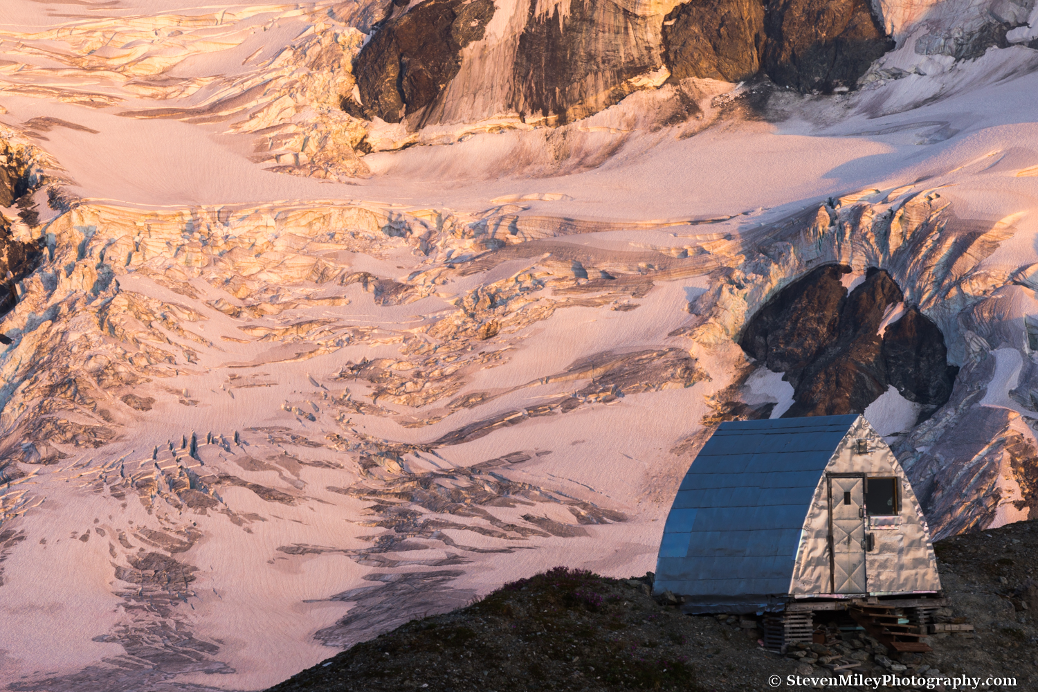
Panoramic view of MacKeith Hut above Canwell Glacier. Icefall Peak & the Moore Icefall are in the background.
I finally visited MacKeith Hut earlier this week, the last of the four mountain huts in the “Deltas” I had left to check out. MacKeith Hut sits above Canwell Glacier in the eastern Alaska Range, about 10 miles from the glacier’s terminus and four or five miles up the glacier from the Lower Canwell Hut, which I’ve stayed at previously. Except for a propensity to lean over time due to its placement on unstable ground, MacKeith Hut is more comfortable than the other huts, and it has been so well maintained (and free of marmots, squirrels, and grizzlies) that you wouldn’t guess it’s been there nearly 50 years. And over those almost 50 years it seems few photographers have been to the hut, even though the nearby scenery is absolutely amazing.
I started hiking to the hut on a hot afternoon following the ATV trail along the lateral moraine above Canwell Glacier. While driving through Red Rock Canyon on the way to the “trailhead”, I startled a grizzly bear in the road and it bolted into the brush, so I scanned the hillside carefully as I walked. I leaped across a roaring creek after a few miles, then left the trail behind as I descended to the glacier.

ATV trail beside Canwell Glacier. The Lower Canwell Hut is visible as a tiny speck on the green hillside across the glacier near the very left edge of the image.
When I reached bare ice I strapped a pair of Microspikes to my hiking boots, which made walking up the glacier a total breeze. I marveled at dozens of moulins and the ice spilling down Institute Peak as I quickly strolled up the glacier. Near the base of Minya Peak, I spotted MacKeith Hut a couple miles ahead. About a half-mile away I began aiming toward the slope beneath the hut, but I ran into crevasse after crevasse which greatly slowed my pace. I realized it would be faster and safer if I returned to the center of the glacier and continued until I was parallel with the hut. I avoided crevasses the rest of the way and hopped off the edge of the glacier onto the slope below the hut, anxious to drop my heavy pack full of photography equipment. I ascended the slope and reached the hut around 1 a.m., where I watched the waning gibbous moon rise over Yeti Pass farther up Canwell Glacier after I settled in for the night.
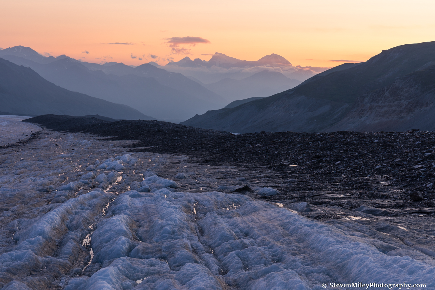
View of Mount Shand & Mount Moffit looking down Canwell Glacier at sunset.
While the sun crept over the mountains after sunrise, wildfire smoke crept up the glacier. For once I hoped the wind would pick up and blow the smoke away. The view looking up Canwell Glacier from the hut was stunning with the Moore Icefall stealing the scene, but I knew it would look just as good or better near sunset.

View looking over Canwell Glacier after sunrise from behind MacKeith Hut.
Looking down glacier the night before I had been able to see the mountains across the Delta River and even Mount Shand and Mount Moffit towering far in the distance, but in the morning I couldn’t see much past Institute Peak through the smoke. After photographing the sunrise I decided to catch a little sleep in the hut.

MacKeith Hut at sunrise with wildfire smoke in the background.
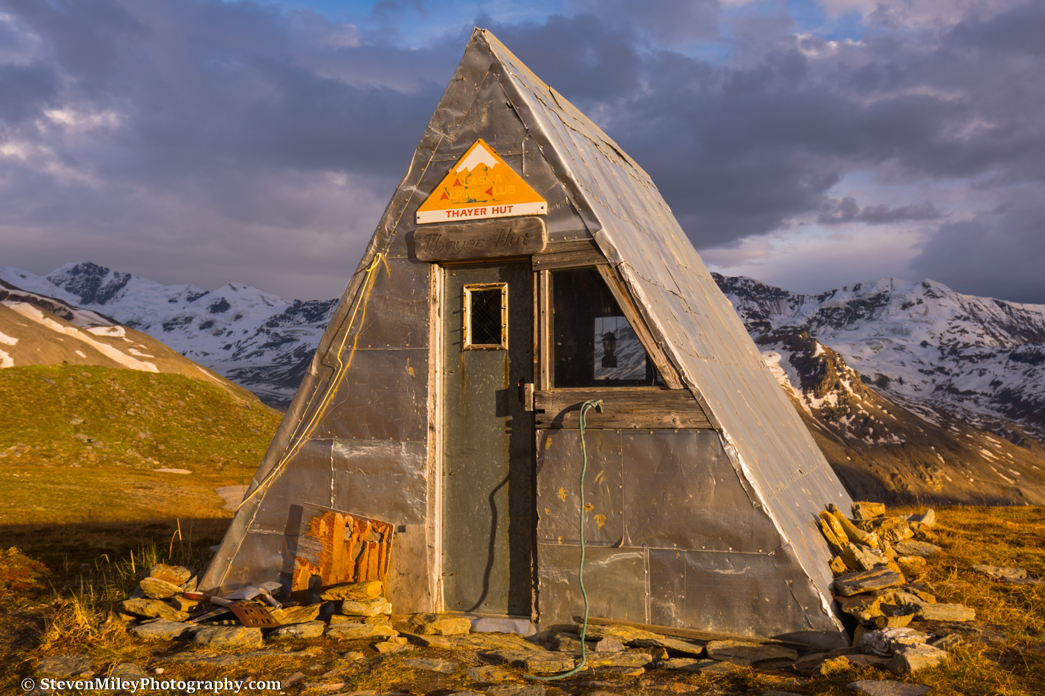
The interior of the hut is plain but functional. There are two large picture windows with beautiful views, and they allow plenty of sunshine in which keeps the hut bright and warm. (By comparison, Thayer Hut is pretty dim even in the middle of the day, and it takes awhile to warm up in the morning.) The hut log is an entertaining read, with stories of mountaineering adventures big and small and the many efforts to level the hut over the years. I was surprised to find edible food stored in the hut (for emergencies) and more surprised to see there had been another party at the hut just a week prior, and another in June.

View of the icefall NW of MacKeith Hut through the front window. The door & frame are painted University of Alaska Fairbanks colors.
The smoke seemed to be retreating by afternoon and the massive icefall northwest of the hut was calling my name. I meandered over the rocky slopes across a few snow patches toward the icefall while scouting locations where I could photograph MacKeith Hut at sunset. The weather couldn’t get any better.

The icefall NW of MacKeith Hut.
After eating my dinner of cheese, peanuts and chocolate chips, a bagel, and a high protein bar, I ventured out to photograph the sunset. In a location like this with so many great vantage points it’s hard to pick which shots to execute and which to forego. I shot as many different images as I could while scurrying around the mountain slope until the light faded, then returned to the hut ready to sleep in past sunrise.
MacKeith Hut at sunset with the Moore Icefall in the background.
The next morning dawned clear and sunny again, and the smoke was still lingering farther down glacier. I ate some oatmeal, packed up, swept the floor, then tied the door latch and said goodbye to the hut. I enjoyed my time there and didn’t come close to exploring everywhere I wanted to, so I’m sure I’ll be back again soon, if not by the end of this summer.
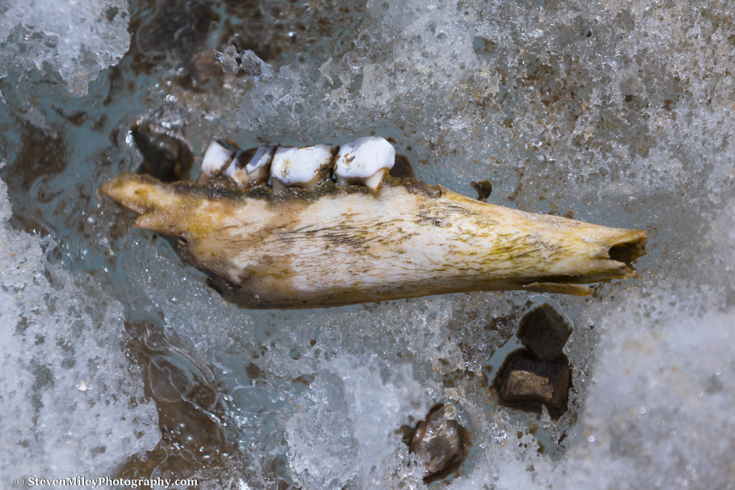
I expected clouds and rain later in the day so I hiked quickly down Canwell Glacier. After a mile or two the smoke made big landscape photos worthless, but I did see a number of cool sights on the ice including a narrow rectangular boulder sticking straight up on its end, a dead and half-frozen hawk, a brown-colored animal bone that seemed to be quite old, and several gaping moulins. I also found someone’s Nalgene water bottle near the base of Minya Peak, probably dropped by one of the parties mentioned above.

A boulder impersonating a tombstone on Canwell Glacier. The bottom of Minya Peak is at upper left.
After regaining the ATV trail above the glacier I caught a ride with a man from Fairbanks who had been riding the trail in his 1976 Toyota Land Cruiser, which sported some giant tires and some rather Alaskan modifications. It was nice to skip the last couple miles of walking, easy as it was. We traded stories about the area as the weather quickly deteriorated, and I made it back to my car in time to avoid the rain.
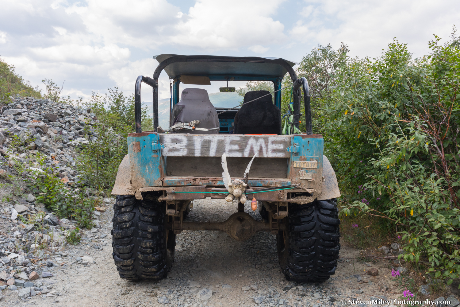
Alaskan hitchhiking at its finest.
During the trip I shot 4K video with my DSLR which I edited into a 3-minute movie of my trip. It’s not totally professional since I was working without lenses, tripods, gimbals, etc. designed for video, and I didn’t spend much time retouching the video clips, but it’s good enough to post, especially since you won’t find another video about MacKeith Hut anywhere. I also didn’t get all the shots I wanted to include because I needed to conserve my camera batteries for photography. It’s embedded from YouTube below. Enjoy!