MacKeith Hut


Directions to MacKeith Hut are available via the Alaska Alpine Club’s website and the Delta Range guide by Stan Justice, available at Beaver Sports in Fairbanks. For advice on locating MacKeith Hut & avoiding nearby crevasses, see this video.
Looking for guided tours of Canwell Glacier? See
Black Rapids Tours.

Panoramic view of MacKeith Hut above Canwell Glacier. Icefall Peak & the Moore Icefall are in the background.

Panoramic view of MacKeith Hut above Canwell Glacier. Icefall Peak & the Moore Icefall are in the background.

I finally visited MacKeith Hut earlier this week, the last of the four mountain huts in the “Deltas” I had left to check out. MacKeith Hut sits above Canwell Glacier in the eastern Alaska Range, about 10 miles from the glacier’s terminus and four or five miles up the glacier from the Lower Canwell Hut, which I’ve stayed at previously. Except for a propensity to lean over time due to its placement on unstable ground, MacKeith Hut is more comfortable than the other huts, and it has been so well maintained (and free of marmots, squirrels, and grizzlies) that you wouldn’t guess it’s been there nearly 50 years. And over those almost 50 years it seems few photographers have been to the hut, even though the nearby scenery is absolutely amazing.

I started hiking to the hut on a hot afternoon following the ATV trail along the lateral moraine above Canwell Glacier. While driving through Red Rock Canyon on the way to the “trailhead”, I startled a grizzly bear in the road and it bolted into the brush, so I scanned the hillside carefully as I walked. I leaped across a roaring creek after a few miles, then left the trail behind as I descended to the glacier.

ATV trail beside Canwell Glacier. The Lower Canwell Hut is visible as a tiny speck on the green hillside across the glacier near the very left edge of the image.

ATV trail beside Canwell Glacier. The Lower Canwell Hut is visible as a tiny speck on the green hillside across the glacier near the very left edge of the image.

When I reached bare ice I strapped a pair of Microspikes to my hiking boots, which made walking up the glacier a total breeze. I marveled at dozens of moulins and the ice spilling down Institute Peak as I quickly strolled up the glacier. Near the base of Minya Peak, I spotted MacKeith Hut a couple miles ahead. About a half-mile away I began aiming toward the slope beneath the hut, but I ran into crevasse after crevasse which greatly slowed my pace. I realized it would be faster and safer if I returned to the center of the glacier and continued until I was parallel with the hut. I avoided crevasses the rest of the way and hopped off the edge of the glacier onto the slope below the hut, anxious to drop my heavy pack full of photography equipment. I ascended the slope and reached the hut around 1 a.m., where I watched the waning gibbous moon rise over Yeti Pass farther up Canwell Glacier after I settled in for the night.

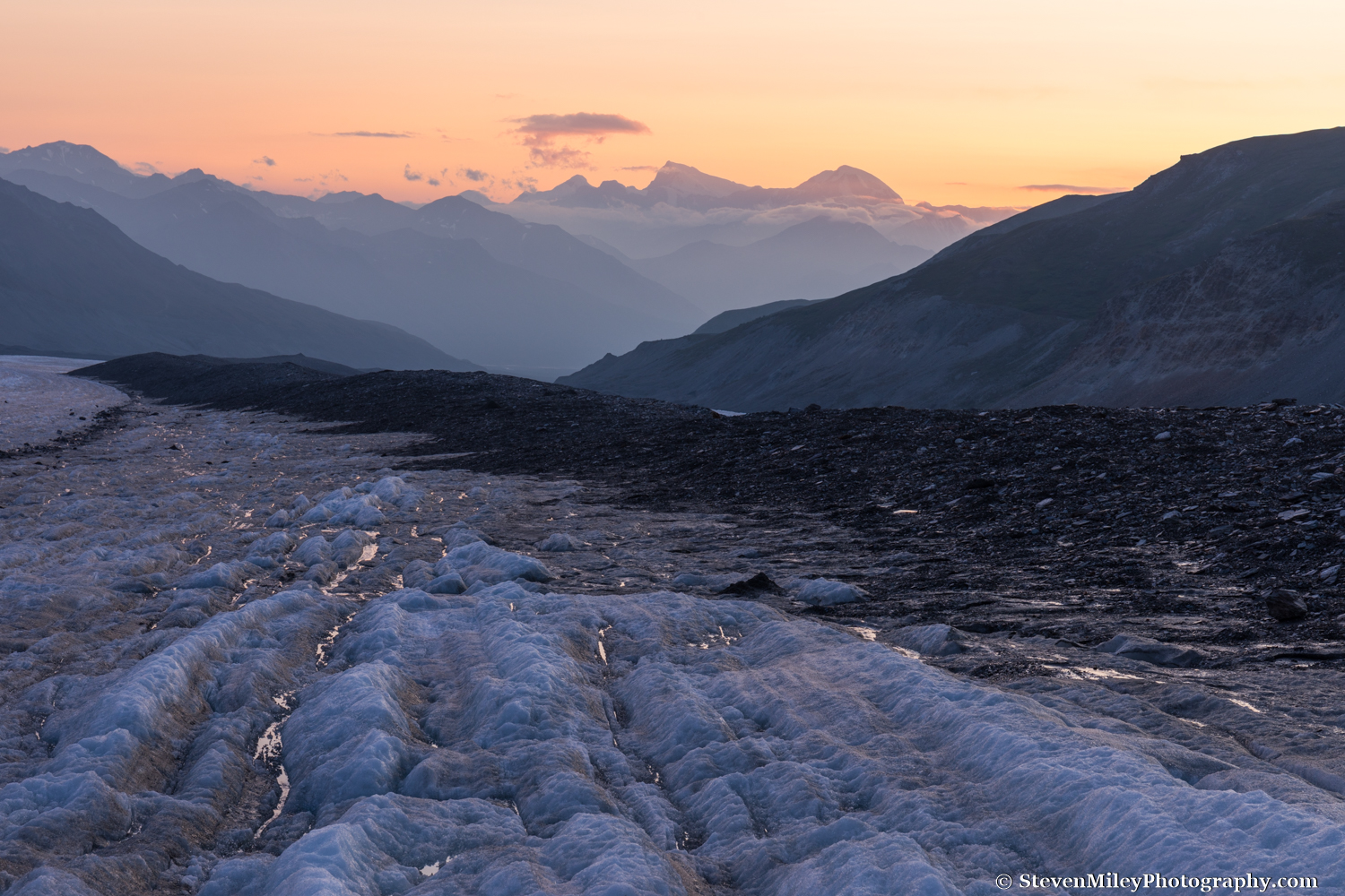
View of Mount Shand & Mount Moffit looking down Canwell Glacier at sunset.

View of Mount Shand & Mount Moffit looking down Canwell Glacier at sunset.

While the sun crept over the mountains after sunrise, wildfire smoke crept up the glacier. For once I hoped the wind would pick up and blow the smoke away. The view looking up Canwell Glacier from the hut was stunning with the Moore Icefall stealing the scene, but I knew it would look just as good or better near sunset.

View looking over Canwell Glacier after sunrise from behind MacKeith Hut.

View looking over Canwell Glacier after sunrise from behind MacKeith Hut.

Looking down glacier the night before I had been able to see the mountains across the Delta River and even Mount Shand and Mount Moffit towering far in the distance, but in the morning I couldn’t see much past Institute Peak through the smoke. After photographing the sunrise I decided to catch a little sleep in the hut.

MacKeith Hut at sunrise with wildfire smoke in the background.

MacKeith Hut at sunrise with wildfire smoke in the background.

The interior of the hut is plain but functional. There are two large picture windows with beautiful views, and they allow plenty of sunshine in which keeps the hut bright and warm. (By comparison, Thayer Hut is pretty dim even in the middle of the day, and it takes awhile to warm up in the morning.) The hut log is an entertaining read, with stories of mountaineering adventures big and small and the many efforts to level the hut over the years. I was surprised to find edible food stored in the hut (for emergencies) and more surprised to see there had been another party at the hut just a week prior, and another in June.

View of the icefall NW of MacKeith Hut through the front window. The door & frame are painted University of Alaska Fairbanks colors.

View of the icefall NW of MacKeith Hut through the front window. The door & frame are painted University of Alaska Fairbanks colors.

The smoke seemed to be retreating by afternoon and the massive icefall northwest of the hut was calling my name. I meandered over the rocky slopes across a few snow patches toward the icefall while scouting locations where I could photograph MacKeith Hut at sunset. The weather couldn’t get any better.

The icefall NW of MacKeith Hut.

The icefall NW of MacKeith Hut.

After eating my dinner of cheese, peanuts and chocolate chips, a bagel, and a high protein bar, I ventured out to photograph the sunset. In a location like this with so many great vantage points it’s hard to pick which shots to execute and which to forego. I shot as many different images as I could while scurrying around the mountain slope until the light faded, then returned to the hut ready to sleep in past sunrise.

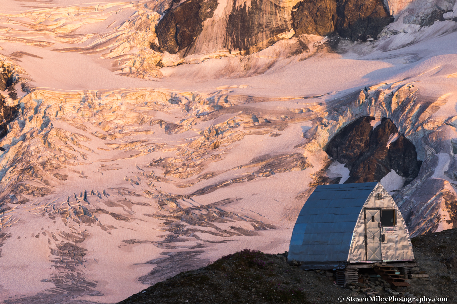
MacKeith Hut at sunset with the Moore Icefall in the background.

MacKeith Hut at sunset with the Moore Icefall in the background.

The next morning dawned clear and sunny again, and the smoke was still lingering farther down glacier. I ate some oatmeal, packed up, swept the floor, then tied the door latch and said goodbye to the hut. I enjoyed my time there and didn’t come close to exploring everywhere I wanted to, so I’m sure I’ll be back again soon, if not by the end of this summer.

I expected clouds and rain later in the day so I hiked quickly down Canwell Glacier. After a mile or two the smoke made big landscape photos worthless, but I did see a number of cool sights on the ice including a narrow rectangular boulder sticking straight up on its end, a dead and half-frozen hawk, a brown-colored animal bone that seemed to be quite old, and several gaping moulins. I also found someone’s Nalgene water bottle near the base of Minya Peak, probably dropped by one of the parties mentioned above.

A boulder impersonating a tombstone on Canwell Glacier. The bottom of Minya Peak is at upper left.

A boulder impersonating a tombstone on Canwell Glacier. The bottom of Minya Peak is at upper left.

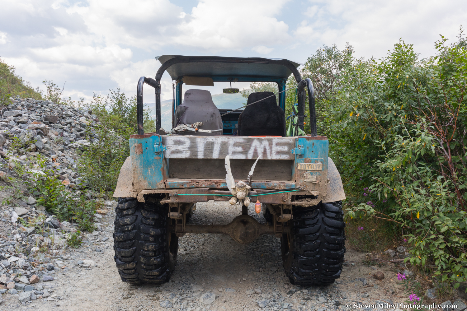
After regaining the ATV trail above the glacier I caught a ride with a man from Fairbanks who had been riding the trail in his 1976 Toyota Land Cruiser, which sported some giant tires and some rather Alaskan modifications. It was nice to skip the last couple miles of walking, easy as it was. We traded stories about the area as the weather quickly deteriorated, and I made it back to my car in time to avoid the rain.

Alaskan hitchhiking at its finest.

Alaskan hitchhiking at its finest.

During the trip I shot 4K video with my DSLR which I edited into a 3-minute movie of my trip. It’s not totally professional since I was working without lenses, tripods, gimbals, etc. designed for video, and I didn’t spend much time retouching the video clips, but it’s good enough to post, especially since you won’t find another video about MacKeith Hut anywhere. I also didn’t get all the shots I wanted to include because I needed to conserve my camera batteries for photography. It’s embedded from YouTube below. Enjoy!


Black Rapids Glacier March 2016

Standing beneath an arch formation, Black Rapids Glacier.

Standing beneath an arch formation, Black Rapids Glacier.

I hiked to Black Rapids Glacier on a beautifully sunny day in March earlier this year. The expected high temperature was in the 30’s, but when I parked alongside the Delta River early in the morning, the temperature was only 3 °F and the sun was blocked by the mountains to the south. I carefully crossed the river ice and started moving quickly up the frozen creek leading to the glacier a few miles away, trying to stay warm.

The first 10 or 20 minutes of hiking were rather chilly until I reached direct sunlight. I stuck to the firm snow along the edge of the creek for a couple miles, then cut across the rocky plain directly toward the glacier as the creek took a detour to the right. After about an hour of hiking, I reached a boulder with a small rock cairn piled on top of it, and from there I could spy blue pieces of glacier ice up ahead. The creek curved back in front of me and I trod carefully across the ice on the final stretch to the glacier. 

I reached a small, couch-sized piece of glacier ice sitting alone in the middle of the creek and stopped beside it for a few minutes to rest. The mountains to my left were casting the valley in shade, and I quickly started to feel just as cold as when I started. With my fingers going numb, I continued up the creek as it began splitting and winding around large pieces of glacier ice separated from the main body of the glacier. 

Eventually, the creek narrowed and the rocky glacier moraine steepened on both sides of it. I would have liked to follow the creek to whatever giant hole in the glacier it must have emerged from, but I wasn’t sure how long of a detour that would have been and I had other sights to see. I climbed up the moraine on the right side of the creek, winding up rocky ridges until I could see a vast ice tongue below me a short distance ahead.  

I found a suitable spot to scramble down to the ice tongue and found myself standing in the sun again on a blindingly bright, white plain of snow-covered ice dotted with several large boulders. I took a break next to one of the boulders, using it to block the cold breeze while I basked in the sun. Eventually, I warmed up enough to break out the camera, which promptly chilled my fingers again. I put the camera away and started hiking around the bend in the valley where the glacier stretches for another dozen miles or so beneath giant mountains.

The snow on the glacier was only a few inches deep on the lower end of the ice tongue and there were several patches of exposed glacier ice. I had scouted my route very carefully beforehand and knew dangerous spots would be obvious. As I gently gained elevation, the snow became a little deeper and the patches of exposed glacier ice started to disappear. I strolled past a couple massive depressions in the snow where glacial streams disappear into the ice in the summer. One of them had a broken plastic marker on its edge placed by a research team. I spotted a massive ice cave where a stream flowing down a valley adjacent to the glacier had eaten away at the ice. I would have liked to explore it, but it was guarded by crevasses.

I didn’t have enough daylight to climb up one of the mountain ridges bordering the glacier, so I decided to climb up the western moraine and hope for a decent view of the main glacier valley.  To reach the moraine, I had to cross over a deep meltwater canyon separating it from the ice tongue—the canyon is clearly visible on Google Earth. In the summer, this would be a nearly impossible task since there would be a raging stream of freezing water flowing through the canyon with steep walls of smooth ice on either side.  In March, however, the canyon is half-filled with snow, and I was able to find a spot where the sides weren’t too steep and crossed over easily. I kicked steps into the snow to climb up the short, steep slope of the moraine.

Unfortunately, the moraine curved across the glacier and still blocked my view more than a mile or two up the valley, but I could now see 12,000+ foot tall Mt. Shand and other craggy peaks rising above the mountain ridges lining the north side of the glacier. I set up the tripod and took a bunch of pictures, then walked along the moraine to get a better look at the ice cave I spotted earlier while I ate the ham & turkey sandwich I packed for lunch.  

Mt. Shand and other craggy peaks of the Alaska Range tower over Black Rapids Glacier.

Mt. Shand and other craggy peaks of the Alaska Range tower over Black Rapids Glacier.

I packed up my gear and started heading back to the highway. Descending the steep slope of the moraine without any crampons or an ice axe was tricky as it was nearly 45 degrees and the snow was very firm, but sliding to the bottom would have been completely safe, if not enjoyable. I recrossed the meltwater canyon and traced my footsteps back down the glacier tongue. The temperature had finally climbed into the 30's and with sun on my back it almost felt like hiking in summer. I started following a much smaller meltwater canyon down the terminal moraine, figuring it would lead to some interesting features. I was rewarded when it brought me to the coolest ice cave I’ve ever seen, except for perhaps the long ice tunnel I’ve visited on Canwell Glacier a few times. 

The ice in the cave was ridiculously clear as it contained very little debris, and the striations usually present in similar caves (and glacier ice in general) seemed to be missing.  I could see daylight penetrating through the ice from above, which is very unusual for the caves I find in the Alaska Range because they typically have a layer of rocks or snow on top that blocks sunlight. There was actually a set of footprints in the dust covering the floor of the cave, but I couldn’t tell how old they were—I’d guess within the last year but probably not the last month. I followed them as the cave curved around and eventually terminated at another entrance flanked with medium-sized pieces of collapsed ice.  In the summer (when there would be water flowing inside) I suspect the cave is even more impressive and photogenic.

My footsteps in the thin layer of silt on the floor of the ice cave.

My footsteps in the thin layer of silt on the floor of the ice cave.

I emerged from the cave and quickly hopped off the moraine so I could move faster as the sun was already starting its descent behind the mountains. I stopped by a massive ice arch I had seen from a distance earlier, and the way it framed the mountains in the late afternoon sun was quite impressive. I put the camera away after leaving the arch and tried to avoid stopping for the rest of the hike as the sun was no longer helping me stay warm.

On these grueling day hikes, the return leg always feels twice as long as the forward journey. I could feel a blister or two developing on my feet and my legs were complaining with every step, but I pressed on, trying to reach the Delta River before dark. After the sun set, I watched the pink alpenglow fade on the mountains for an hour, with Mt. Silvertip glowing a full 20 minutes or so beyond the rest. Institute Peak shined like a ghost in the twilight several miles away, but then the mountains started growing dark. I could hear vehicles on the highway but I still had a mile or so to go. I slowly accepted that I would have to cross the river in the dark.

After what seemed like an eternity, I finally made it to the edge of the river. I pulled out my headlamp and flashlight and started to slowly retrace the same path I took earlier. With the flashlight pointed at the ice, I could easily see the bubbles and rocks frozen several inches below the surface. I no longer felt hesitant and crossed quickly to the other side, relieved that it wasn’t as frightening as I expected it would be. I wasted no time scrambling up the final slope between me and my car, and after 15+ miles of moderately strenuous hiking with 25-30 pounds on my back, my legs finally got to relax as I drove home beneath the aurora.  

For tips on photographing ice caves, read my post How to Photograph An Ice Cave.
Want to see Black Rapids Glacier? Check out my Black Rapids Tours winter offerings.