Crossing Hayes Glacier. The base of Mt. Hayes is at right.
This is the second entry in a series covering my traverse from Black Rapids to Healy in early August 2018. Read Part I.
After three days of hiking we found ourselves about one day behind our estimated schedule for reaching our first food drop, which was waiting for us at an airstrip along the East Fork Little Delta River. We all had enough food to stretch an extra day but our pace was going to be slowed by another set of glacier crossings. Trident Glacier was the next obstacle in front of us, almost two miles wide with no clear path to the opposite side.
Day 4:

Threatening clouds loomed in the distance as we scrambled onto Trident Glacier. Everyone was exhausted from the physical and mental stress of the previous day, and starting the morning off with a rugged glacier crossing didn’t aid in our recovery. But when we passed a captivating bulge of rock-free ice everyone stopped to marvel and take pictures, briefly forgetting the continuous need to cover ground. These were the sights we came for, and we were going to enjoy them no matter how tired we were.

Steep, winding ice slopes and meltwater canyons forced us to take a circuitous path across the moraine of Trident Glacier. Climbing over hill after hill on a glacier like this is always slow-going and frustrating, especially with a heavy pack.
After crossing the Trident we reached a wide creek bed. The clouds were quickly lowering and we knew we were going to lose visibility again soon. We crossed a small braided stream and waded through marshy grass, which took some time because most of the team changed footwear to keep their hiking shoes dry. As we continued up the creek bed we spotted a caribou and two—people? They were presumably hunters dropped off by a bush plane, and they must have been surprised to see us pass by. We then climbed up a short, steep ridge following a game trail which led us onto a tundra plain full of squishy tussocks…and back into the fog. We navigated for another few miles without being able to see much, and we ultimately camped beside a small puddle that provided water for cooking. Several caribou passed our camp that night and the next morning.
Day 5:

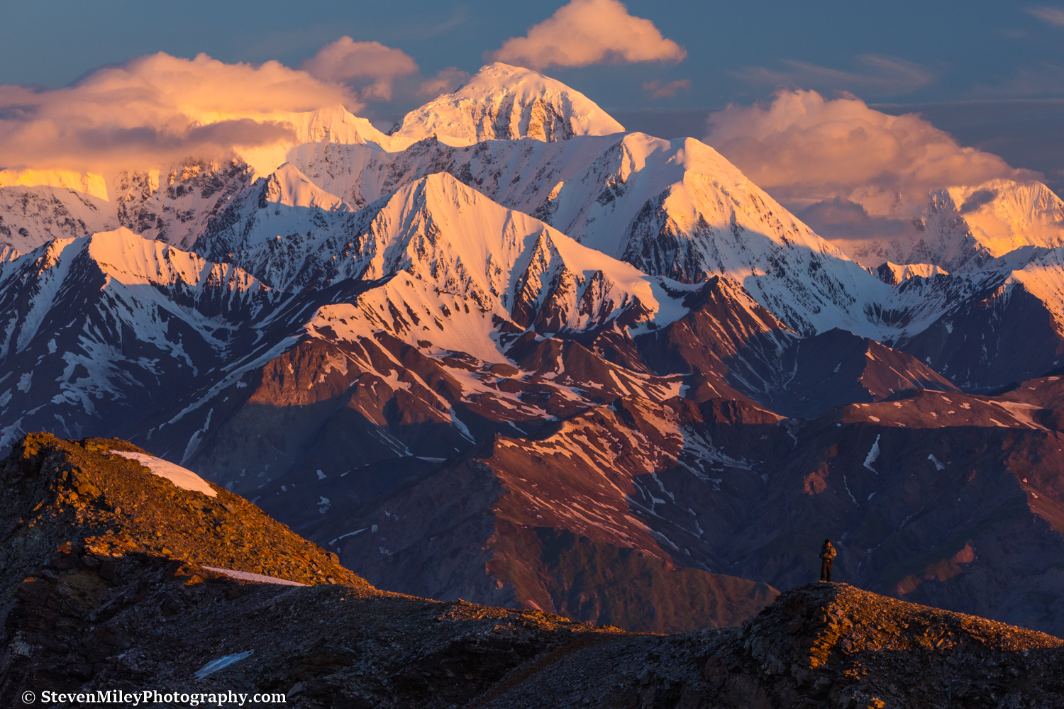
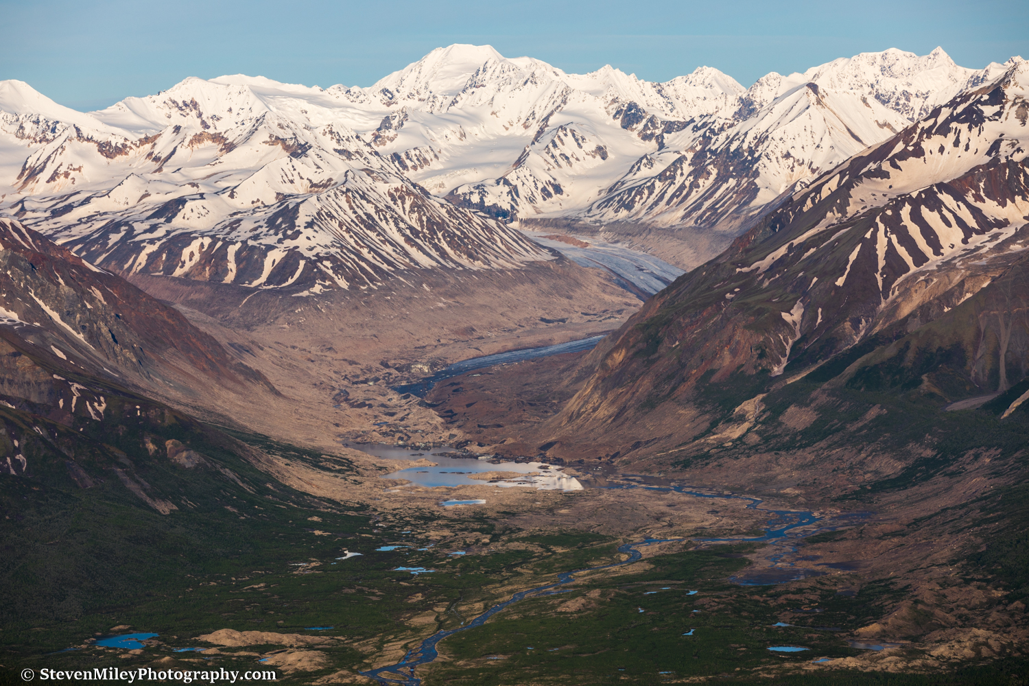
In the morning we could see the bottom half of Mt. Hayes but the summit remained obscured. We hiked across tundra to the eastern branch of Hayes Glacier, then opted to walk along the vegetation-covered moraine of the glacier for a short distance until we were in position to cross to the foot of Mount Hayes on the opposite side.

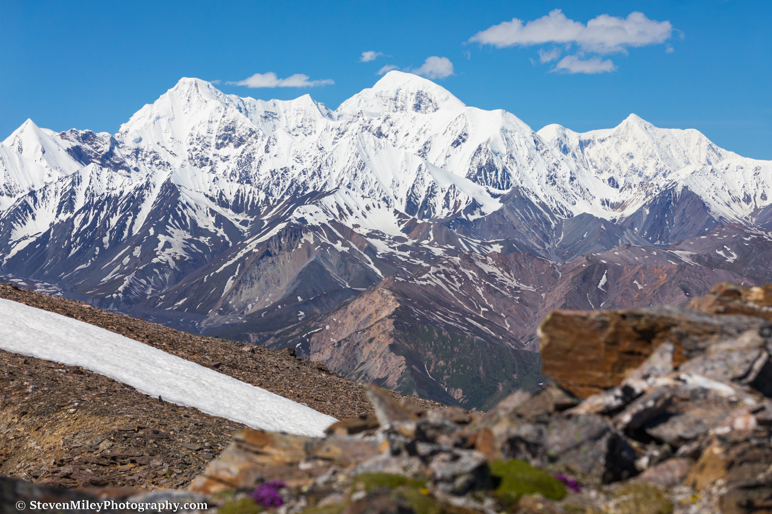
Everyone’s mood lifted as we began crossing Hayes Glacier and the scale of the mountains unfolded before us, overcast skies notwithstanding. I could get lost for weeks in a spot like this. From here you could easily walk right up to the base of the unnamed 10,000+ foot peak in this shot, or to the bottom of the 8,000-foot northeast face of Mount Hayes.

Finding water on a glacier in the summer is never a challenge. After taking a break here to fill up on water and eat lunch, we finished crossing the eastern branch of Hayes Glacier and stopped by two decaying cabins next to the foot of Mount Hayes. Ground squirrels had taken over the cabins (wood floors in the Alaska Range are asking for trouble) and a grizzly bear had left its mark in one of them. We actually bumped into the owner of the cabins a day later, who said he hadn’t been there in years. What a waste…

It’s odd how glaciers are all so unique, even two as close together as the east and west branches of Hayes Glacier, which originate from opposite sides of Mount Hayes and eventually intersect. On the western branch there are several giant boulders propped up on pedestals of ice which have been insulated from the sun, probably more than I’ve seen on any other glacier I’ve hiked on. There are also moulons everywhere on this branch, ranging from rabbit hole-sized to subway tunnel-sized. For some reason, the bare ice on the western branch of Hayes Glacier is also more slippery than every other glacier I’ve hiked on—so slippery I would have preferred using a pair of Microspikes for traction, which I normally don’t need. It was a little too slippery for my companions, so we hugged the rocks as much as we could until we hopped off the glacier onto the adjacent hillside, which was annoyingly brushy considering we were still over 4000 feet elevation. We set up camp just before rain started falling again.
Day 6:

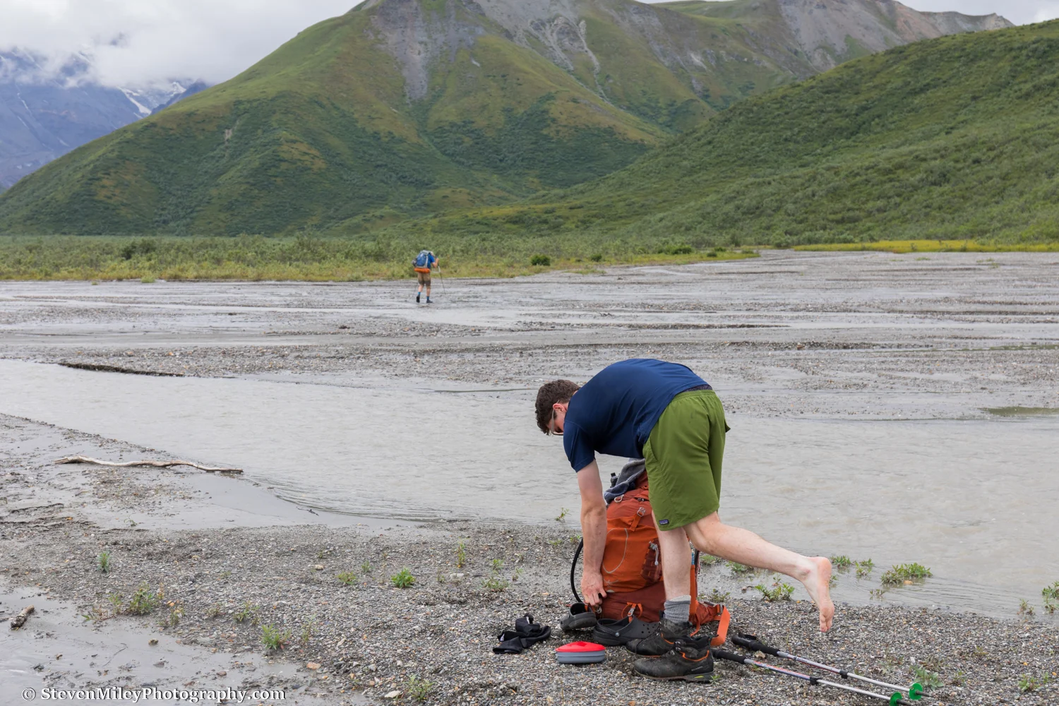
Route finding from Whistler Creek (seen here flowing into the East Fork Little Delta River) to our first food drop was difficult. The brush was dense in between, and it was unclear if following gravel bars would be easier due to the high water conditions. Rain began falling as we reached Whistler Creek, which was swollen from the previous days’ rain and breaching its bank in places. The water didn’t appear that deep but it was flowing incredibly swiftly and was unquestionably dangerous. The creek was not very braided where we intersected it, so we hiked upstream to find a better crossing, though nothing looked very safe. The two guys in our group with the most Alaska backcountry experience crossed first and successfully reached the far side, but two others in our group lost their footing as they crossed together and were swept a short distance downstream. They were lucky they weren’t injured, although one lost his hiking poles.
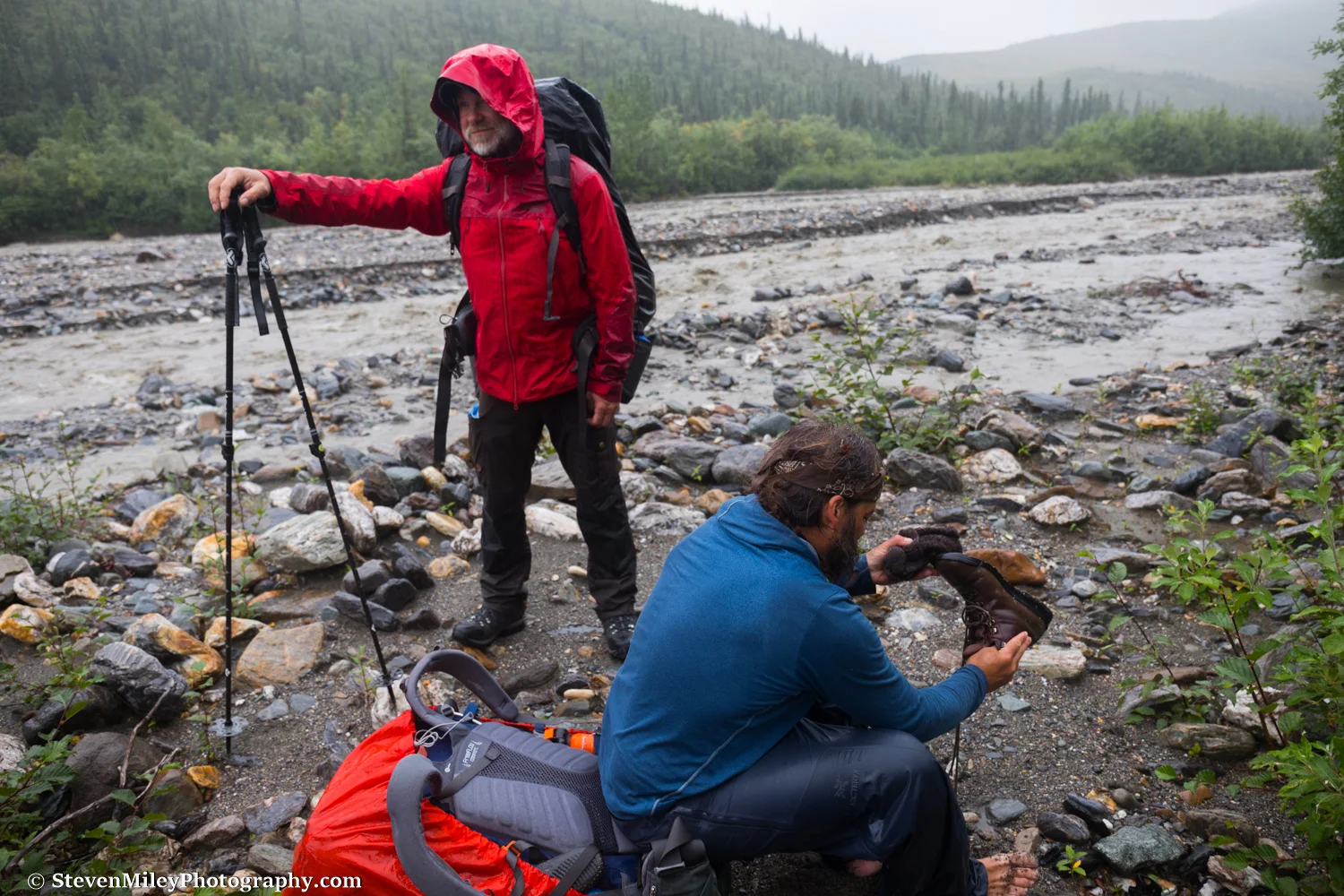
At first I tried to cross solo but I quickly realized the water was eating away the gravel under my feet, making it difficult to resist the force of the water. I was still holding my boots in my hands and decided I should put them away to be safe, so I stepped back onto the gravel bar before I became committed to crossing. One of the two other guys still waiting to cross was very apprehensive after watching the two others fall into the creek, so the three of us decided to cross together in a line facing upstream, one behind the other. I was in back, and as we crossed I could feel the weight of the two men in front of me being pushed back by the creek. I found a boulder with my right foot and braced myself against it, propping them up so they could move laterally without being forced downstream. We successfully made it to the other side, where some of us changed footwear and put on dry clothes. If I were to do this again, I would take the long way and bushwhack downstream until I found a more braided spot to cross. It’s just not worth the risk.

The water in the creek was so powerful it was sending big rocks hurtling downstream. A couple of guys received some nasty cuts and bruises on their shins. Thankfully, I had people in front of me to block any rocks coming at me. The rest of the way to the airstrip was a complete slog in the rain through flooded forest and soggy tundra. The blueberries were great, though.

From left to right: me, Peter, Mike, John, Tim, Decker, Phillip, and Grant. John (in red) had a family emergency and had to depart when we finally reached the airstrip. The sun shined briefly as we took this group shot before he flew away, then it promptly disappeared for another three days. Tim and Decker had only planned to hike part of the way and both were set to fly out the next day. The next morning while everyone was still in their tents, Mike, who had been struggling to keep up at the end of each day, began a speech informing us his body just couldn’t handle the strain and he was calling it quits. He expressed concern about us continuing with the water levels so high, especially crossing the West Fork Little Delta River, and he listed cabin locations where we could find shelter if necessary. When he finished, Peter said he came to traverse the eastern Alaska Range and was prepared to continue by himself if need be, and I expressed my desire to complete the traverse as well. The brothers Phillip and Grant chimed in and said they were ready to keep going, too.
Just like that, we were down to four people with about 80 miles left to go. Read Part III & Part IV.