Denali looms over Peters Glacier (coming out of the valley at right) and the Muddy River. An avalanche is visible near the center of Denali's Wickersham Wall.
Denali from Wonder Lake looks big, but it still looks far away, static and bit hazy. Yet, except for a few backpackers who follow the well-documented route to McGonagall Pass every summer and the occasional park ranger or old-school mountain climber, virtually no one tries to get closer to the mountain on foot than Wonder Lake. One of my goals this summer was to hike close enough to Denali to feel truly humbled by its size and create unique images of the mountain from close range. I looked at the map and found a simple route leading from Wonder Lake to Peters Glacier, which winds around the base of Denali's Wickersham Wall and Pioneer Ridge. The route would be easier than hiking to McGonagall Pass and would also bring me closer to Denali's North Peak, with better views of the mountain along the way. I found extremely little information and few photos of this area of Denali National Park on the web, which made it that much more intriguing.
With only a couple weeks left until the end of bus service in Denali National Park, I set out for Peters Glacier with a less-than-optimal weather forecast, but perhaps the best I might get until next summer. I picked up my backcountry permit at the Backcountry Information Center and caught the last camper bus into the park. The fall colors were in full swing and I had to resist the urge to hang out the window with my camera as the bus wound around the dizzying cliffs near Polychrome Pass. At the end of my six-hour ride, the bus driver dropped me off at the McKinley Bar Trail and handed me a few snacks as a gesture of good luck. ("You won't find any social trails out there," he told me.) The sun had already set and I hiked down the trail under twilight to the McKinley River, where I staked my tent down on the gravel bar using rocks and went to sleep.

Camping on the McKinley River Bar
The next morning I awoke to low-lying clouds blanketing the river and blocking the Alaska Range from view. I packed up my gear, then crossed several shallow braids of the river on foot until I came to a braid that was deep enough to float. I inflated my pack raft, tied my backpack to it, then pushed off into the water, unsure of what surprises the river might provide but confident they wouldn't be problematic. After a few minutes I passed a caribou skull lying upside down on the gravel bar with antlers still attached, which I optimistically viewed as a good omen. After a mile or so, I saw a man hiking upstream on the south side of the river. I paddled to shore to greet him and make sure he was alright. His wife was waiting at camp while he scouted the river for a spot to cross back over to the Bar Trail. The couple had originally intended to hike to McGonagall Pass, but that backcountry unit was full when they arrived at the park so they had attempted to hike to Peters Glacier in the neighboring unit instead. They ran out of time, but for a couple from San Francisco on their first trip to Alaska I was rather impressed by how far they made it. They were the last people I would see until I returned to the McKinley Bar Trail three days later.

Preparing to pack raft the McKinley River from the McKinley Bar Trail to the Muddy River.
After a few miles the gravel bar narrowed considerably and it became easier to avoid getting stuck in shallow braids. I paddled around a few potentially dangerous boulders and trees in the water as the river carried me swiftly downstream, but the hazards were minimal. I reached the confluence with Clearwater Creek and for several hundred feet the crystal clear water from the creek flowed parallel to the silty water of the McKinley River without mingling; I could see the river bottom on my left, but couldn't see an inch below the surface on my right. I arrived at the confluence with the Muddy River a short time later and dragged my raft ashore. At that moment light drizzle began falling and I decided to take shelter under my raft in the trees nearby while I waited for the rain to pass. The rain intensified and it became clear it wasn't going to stop anytime soon. With temperatures falling close to freezing at night, I didn't want to risk hiking in the rain all day and becoming soaked—bad memories of my recent Katmai trip were still fresh in my mind. Instead, I set up my tent underneath my raft and spent the rest of the day and most of the night wondering if the rain would ever stop.
The sun was shining on the McKinley River when I stepped outside my tent the next morning. Clouds were still blocking my view of the Alaska Range but they seemed to be dissipating quickly. I walked around the gravel bar looking at wolf, moose, and caribou tracks as I warmed up in the sunshine. Soon, an impressive snow-covered mountain emerged in the distance: it was Mt. Foraker, Denali's "little" buddy to the west. Minutes later, Denali's North Peak emerged above the clouds, towering impossibly high in the sky and completely dwarfing the 17,400-foot Foraker.

Denali sporting fresh snow on a brisk fall morning, viewed from my campsite at the confluence of the Muddy River and McKinley River.
I was behind my planned schedule due to the rain, but I could see fresh snow at low elevation in the distance and I knew there would probably be too much snow on Peters Glacier for me to hike all the way to the Wickersham Wall as I had hoped, anyway. After drying out my camping gear in the sun, I stowed my raft and started hiking up the Muddy River. I stuck to the east side of the gravel bar except where the river forced me into the brush, which I found surprisingly easy to walk through unlike the horrid bushwhacking that I usually find along the edges of most creeks and rivers in Alaska.
With Peters Glacier in sight and sunset approaching, a bull moose suddenly appeared on the opposite side of the river. Two females emerged from the brush and joined him, and they cautiously observed me for some time even though I backed up considerably. The light wasn't perfect but I snapped as many shots of the moose with Denali towering in the background as I could until they finally crossed the river and disappeared into the brush.
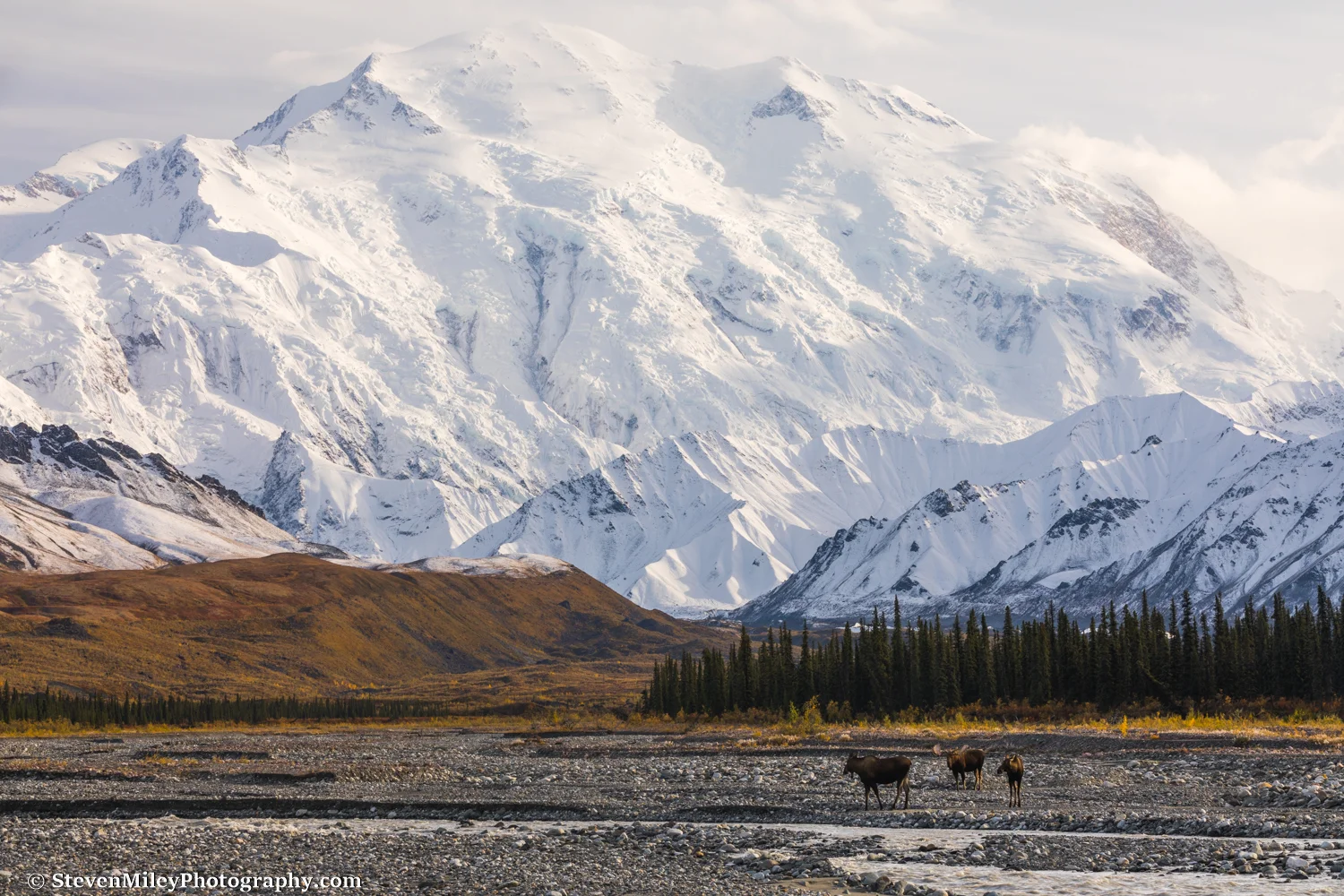
A bull moose and two cows on the gravel bar of the Muddy River with Denali in the background.
As soon as the warm color of sunset began to drape the mountain, I stopped worrying about covering distance and focused on taking photographs since I knew this might be the only decent sunset or sunrise I might see during my entire trip. (And it was.) I was so close to the mountain I saw an avalanche tumble down the Wickersham Wall, and several seconds later I heard the rumble. Unfortunately, distant clouds on the horizon blocked the best of the evening alpenglow. I set up camp in the brush hoping to catch the alpenglow at sunrise.

Denali's Pioneer Ridge and North Peak are lit up at sunset.
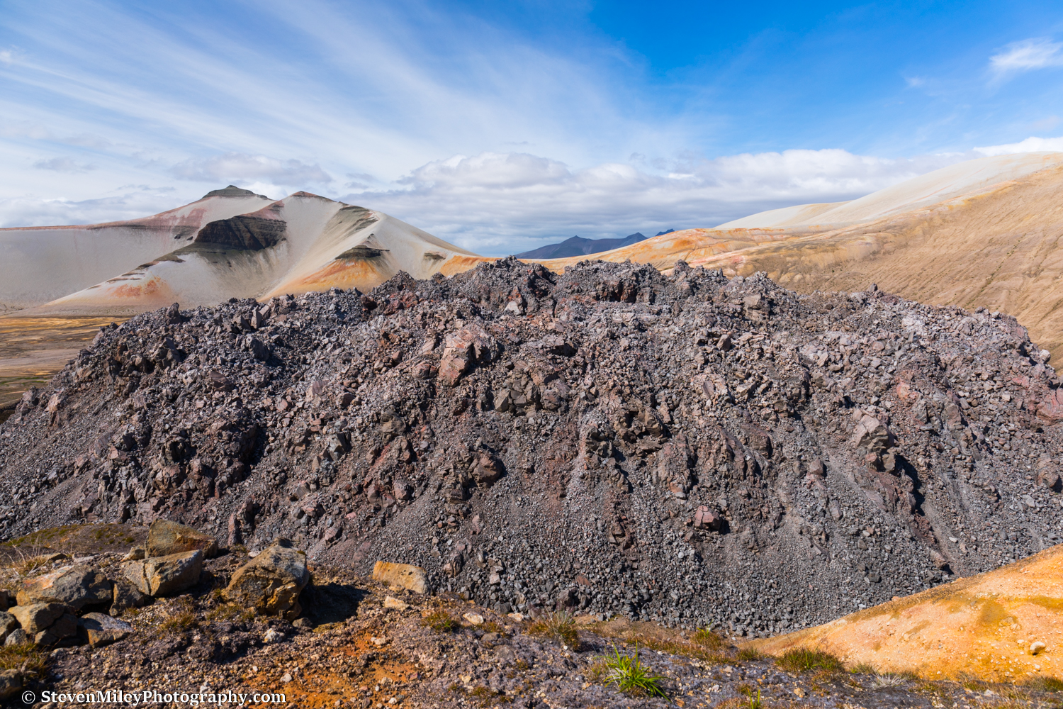
The next day dawned overcast, though the mountain was still completely visible. I entertained no expectations of capturing any stunning mountain images that day, but I was intent on gaining a clear line of sight to the base of Denali before turning back. I followed the Muddy River as it narrowed into a single channel and curved to the west, then hopped onto the moraine of Peters Glacier, which is covered in debris and vegetation near the terminus. I worked my way across the moraine to the tundra bordering the east edge of the glacier and climbed up the hillside, passing tons of berries and signs of bear.

Hiking among the rocks and boulders on the moraine of Peters Glacier.
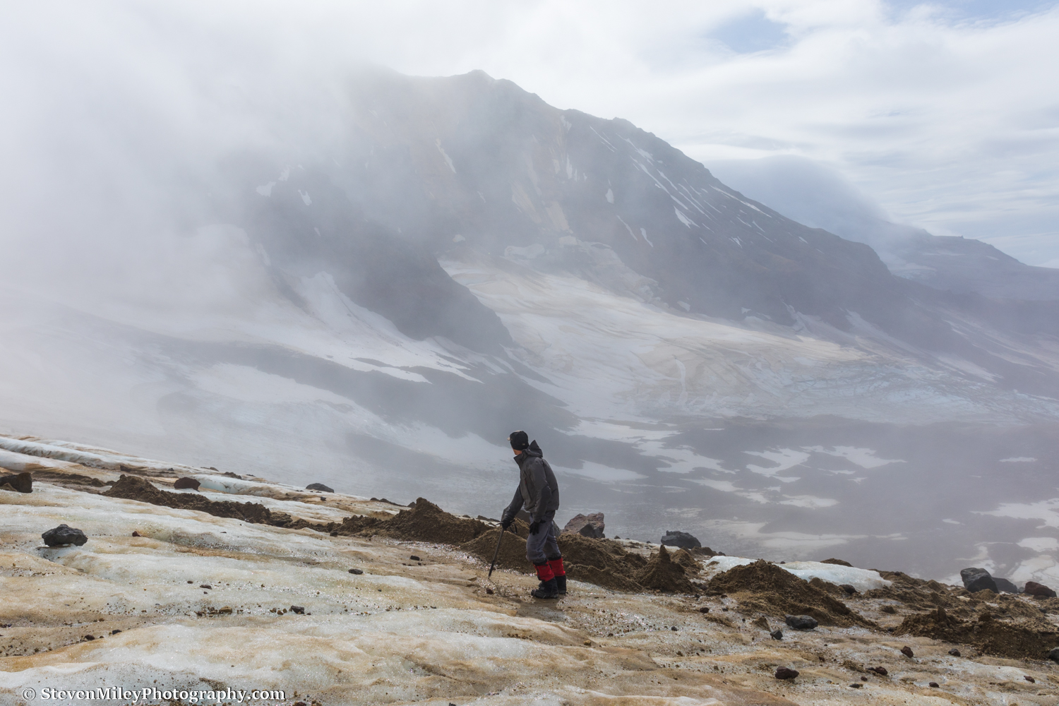
As I gained elevation, I encountered thin patches of snow that hadn't melted since the storm a couple days prior. When I reached a high point on the hillside, I could finally see the bend in Peters Glacier where it curved around the base of Pioneer Ridge. Denali was so close I felt like I could reach out and touch it. A few more miles of easy hiking and I could have done so.

The base of Denali meets Peters Glacier.
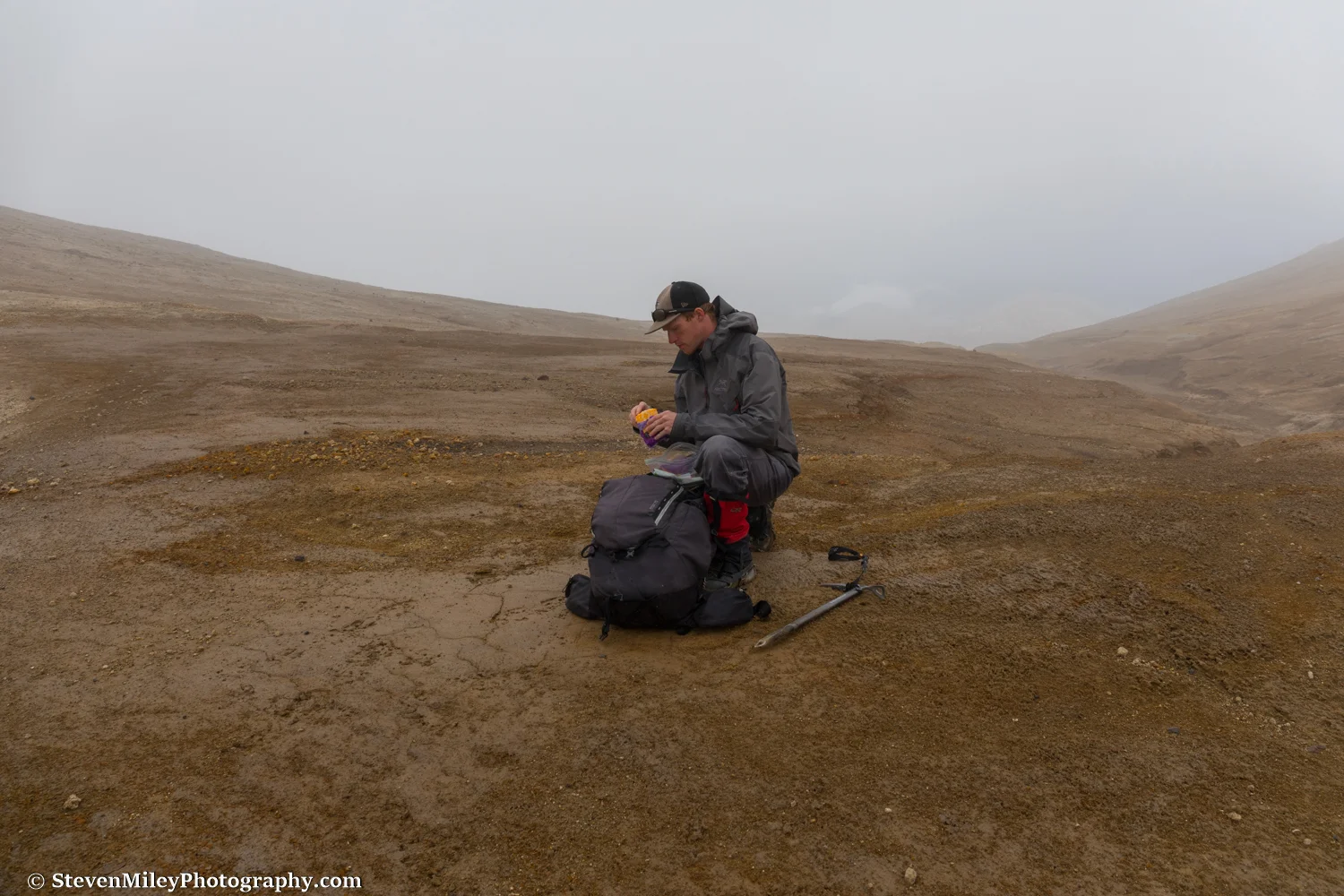
In the other direction, I saw the 20+ miles I would need to hike by 4 p.m. the next day to catch the last bus back to the park entrance. As much as I wanted to overstay my permit, I knew I could easily come back next year in better weather and spend more time exploring. I started my trek back to my campsite, pausing occasionally to gulp down a handful of blueberries.

Possible ice cave formation in the moraine of Peters Glacier.
When I reached camp, I ate the last of my Colby Jack cheese, packed up my gear, then started hauling my heavy pack down the Muddy River until it was too dark to hike any further. I set up camp on the gravel bar with the McKinley River in sight about three miles away. Clouds hovering over the peaks of the Alaska Range ruined another sunrise the next morning, but the rest of the sky was clear and the day had warmed up quite nicely by the time I reached the McKinley River. I retrieved my pack raft, which noticeably slowed my pace and weighed on my tired legs and shoulders.
Hiking along the McKinley River was just as nice as the Muddy River until I reached Clearwater Creek. The creek was swift and deep, but I didn't want to waste time inflating and deflating the pack raft so I waded through the thigh-deep icy water. At the deepest point, I started thinking perhaps I shouldn't be filming with my expensive, non-waterproof DSLR, but I could see clear to the bottom and knew the current wasn't going to get any worse. The sun was shining brightly and I dried out quickly after crossing. I crossed and re-crossed one problematic braid of the McKinley River a few miles later, but that water only came up to my knee.

Immediately downstream of the confluence of Clearwater Creek and the McKinley RIver. The water is very swift and deeper than it looks in this image.
I spotted a bright, stationary yellow object across the McKinley River near the Bar Trail and surmised it must be a tent. As I crossed the numerous braids of the McKinley River, the deepest of which reached the top of my thigh (though it seemingly wasn't as powerful as Clearwater Creek), I realized the object was actually a jacket worn by a person relaxing in a chair on the other side of the river. In fact, there were several people mulling around on the safe side of the river enjoying the nice weather and mountain views. I couldn't help but think Denali looked a bit small and hazy when I turned around to view it one last time before hiking up the Bar Trail back to the park road.