Mount Katmai Crater Lake

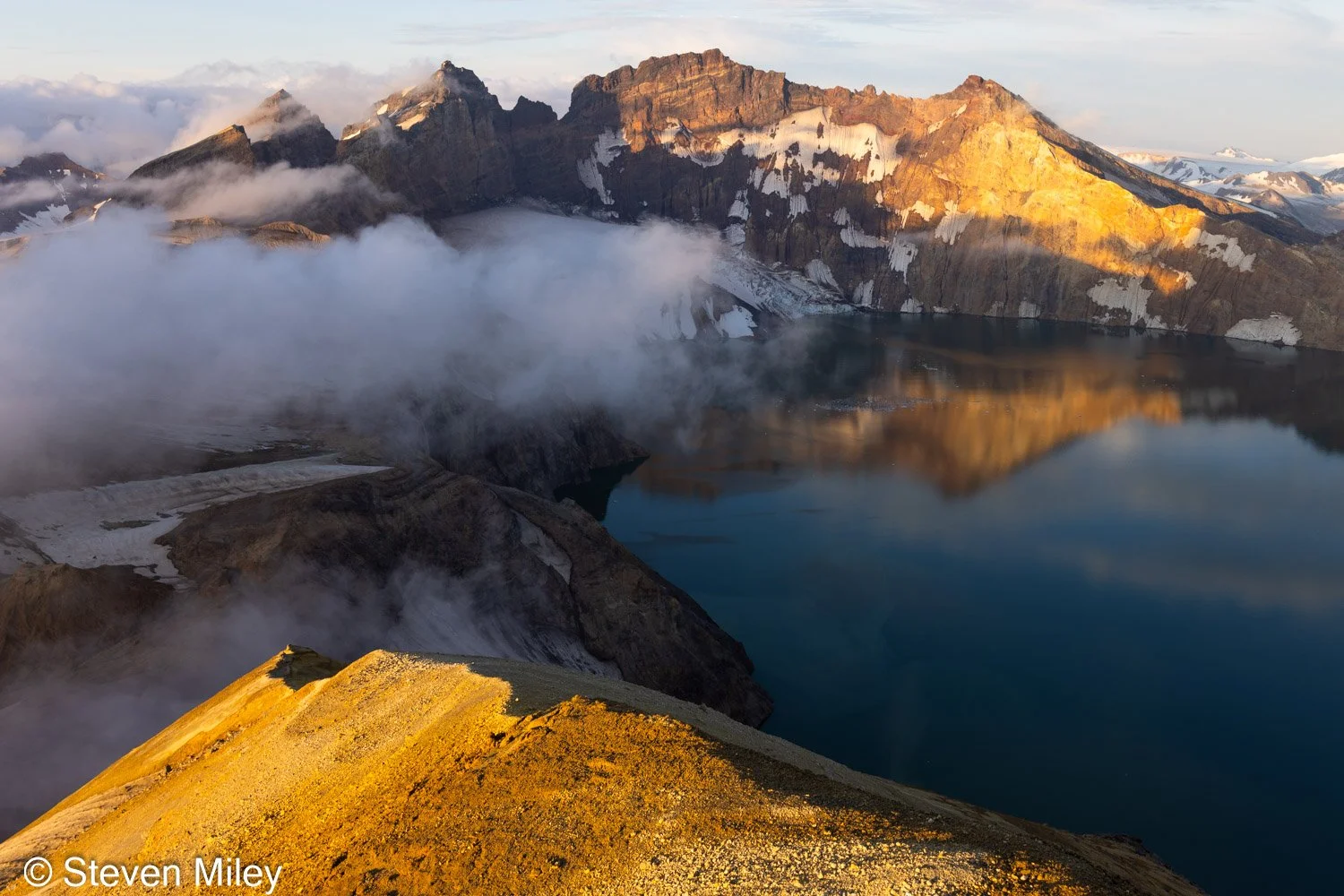
Mount Katmai Crater Lake at sunset, looking N towards the true peak of Mount Katmai.

Eight years after my last attempt, I finally returned to the Valley of Ten Thousand Smokes and reached the caldera of Mount Katmai. I might be the first photographer to ever camp on the caldera rim and capture this amazing place in prime sunrise and sunset conditions due to its remoteness and the inhospitable environment on the rim. I even caught the aurora over the crater lake one night!

My adventure buddy Ryan accompanied me on the trip. We met up in King Salmon in late August and flew into the Valley of Ten Thousand Smokes with Sam Egli, who operates Egli Air Haul. While circling over Baked Mountain, we saw the Baked Mountain Huts had indeed been completely destroyed after my last visit, though the outhouse is still standing. Sam dropped us off near the base of Baked Mountain, placing us about 9 miles from the caldera rim as the crow flies, though our actual route would push closer to 14 miles. The first half of the route was straightforward as we paralleled Baked Mountain and wound around Novarupta, the site of the cataclysmic volcanic eruption that buried the valley in volcanic debris in 1912. We sank in the ash with every step, like walking in sand on the beach, but on fresh legs the hiking felt easy. Near Novarupta we spotted a caribou cow & calf crossing a snowfield, the only sign of life in the valley we had seen up to that point. The steep final ridge we’d need to climb to reach the caldera rim loomed in the distance beyond Novarupta.
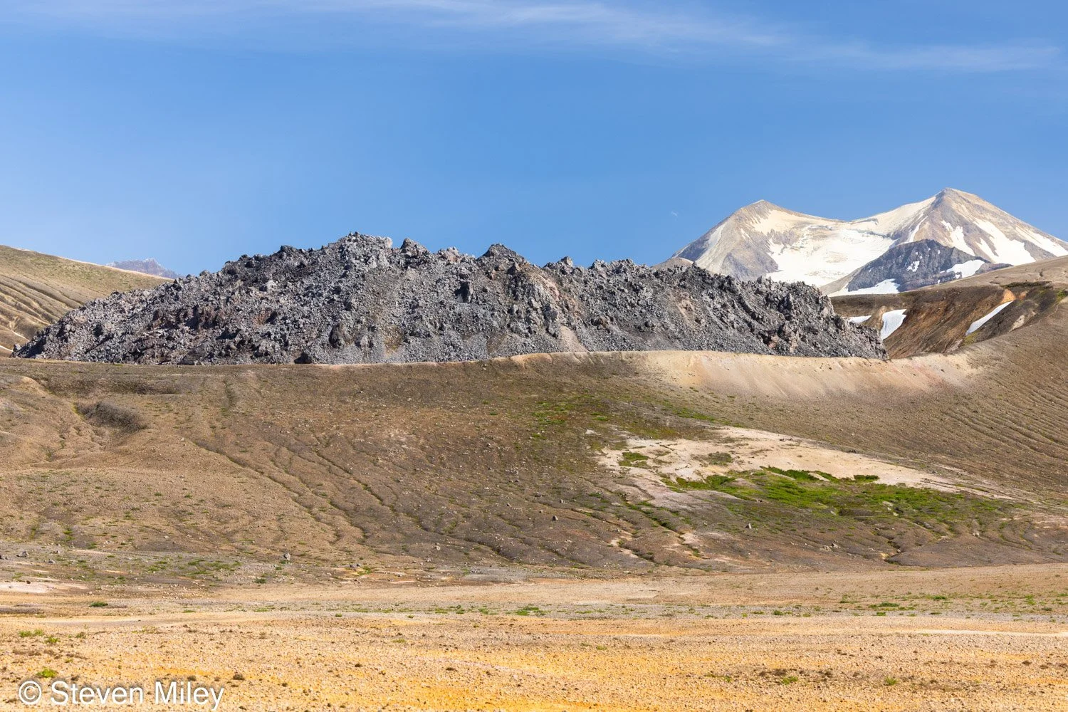
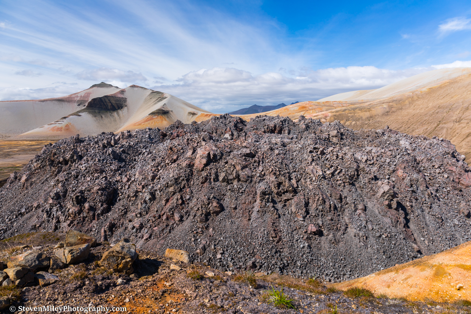
Novarupta (foreground) with the west subpeak of Mount Katmai in the background. We ascended the lefthand ridge and camped on the peak.

As we approached the edge of one of the Knife Creek Glaciers, routefinding became much more difficult. Attempting a direct route across the middle of the glacier was impossible due to the steep canyons carved by meltwater running down the glacier. The upper glacier was much smoother and looked easier to navigate but there were crevassed areas to avoid and some obstacles we couldn’t clearly see around from our perspective, so we opted to drop about 1000 feet of elevation and climb up the toe of the glacier following a route that I had roughly followed the last time, which avoided crevasse danger and ensured no insurmountable obstacles, though it added significant distance and elevation gain. Ryan and I had to cross one deep and fast flowing glacier stream to access the toe, and we succeeded by rolling a giant pumice boulder into the creek and jumping onto it to cross to the other side. If it had been a normal boulder, it probably would have weighed over 1000lbs and we’d never have gotten it to budge, but all the volcanic rocks in the valley are deceptively light.

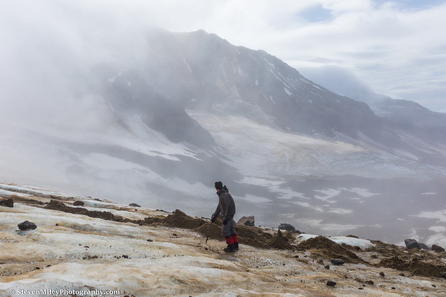
Once on the glacier, we labored up steep hills with the loose ash sliding beneath our feet. It almost felt like snowshoeing in deep powder. Ryan ran out of gas somewhere on the glacier but continued on fumes until we hit solid névé where the hiking became significantly easier, though no less steep. We ascended to the pass between Mount Katmai and Trident Volcano just after sunset, settling on a campsite near the base of the ridge leading to the west peak of the Mount Katmai caldera.
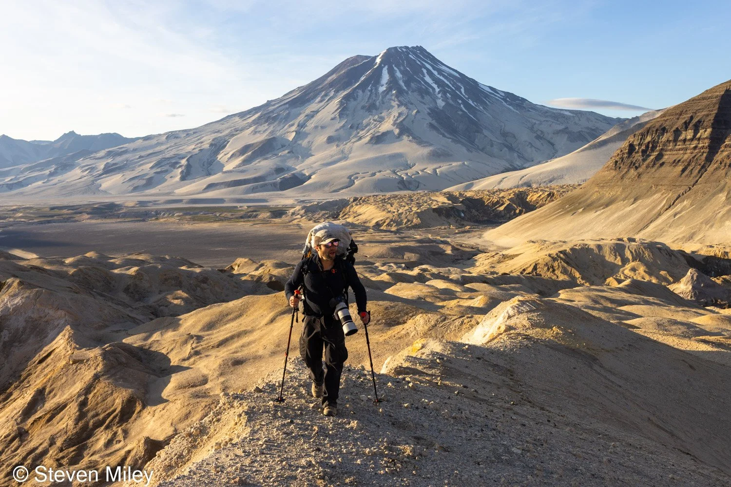
Ryan hiking up one of the ash-covered Knife Creek Glaciers with Mount Griggs in the background.

The next morning we packed up camp and wound our way across a maze of snow-filled runnels to the base of the summit ridge. Trident Volcano towered majestically in the morning sun behind us, looming over the head of one of the Wishbone Glaciers. Mountains, snow, ice, and ash deposits merge together here to form the most alien landscape I’ve ever seen.
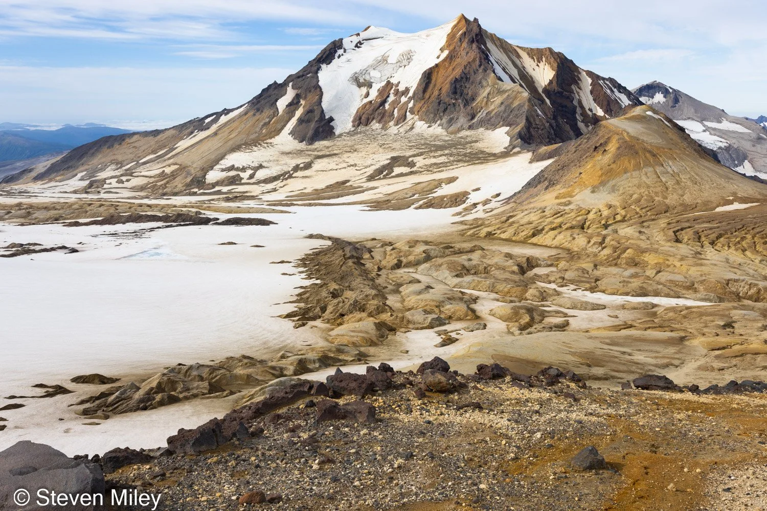
View of Trident Volcano. Our first campsite was near the base of the runnels at right just below the pass between Trident Volcano and Mount Katmai.

The ridge was easy to navigate without any scrambling required or major obstructions to circumvent, but the soft footing made hiking extra difficult on our tired legs. The volcanic rocks embedded in the ash looked like stable footing, but they would sink deeper or slide down the mountain when we put our weight on them unless they were very large. We struggled up the 1700-foot ridge for over two hours, about twice as long as I would normally take to ascend a ridge with more solid footing while carrying a heavy pack.
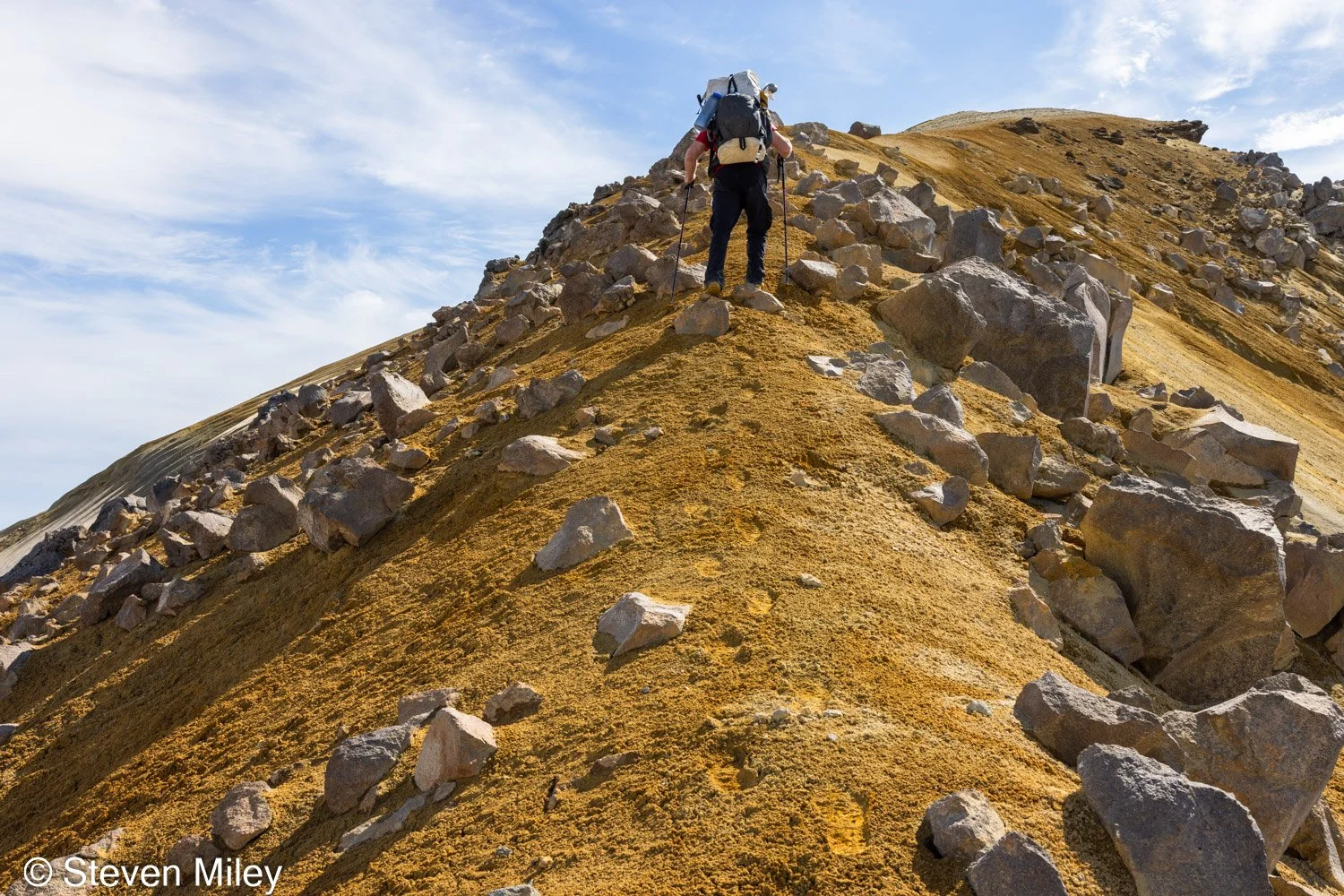
Climbing the steep ridge to the western peak of the Mount Katmai caldera.

As we neared the summit, we caught our first glimpse of the crater lake as we rose above the saddle to our left. Even just this partial glimpse of the lake was so astounding I forgot how tired my legs were. I sped up to reach the top and as the ridge rounded over the entire turquoise lake suddenly emerged before me, the centerpiece of a marvelous 360-degree view including Mount Griggs, Trident Volcano, a sea of smaller mountains and sprawling icefields, and the Pacific Ocean. The rim of the caldera reflected in the still lake as chunks of ice from the glaciers inside the crater drifted slowly across the water.
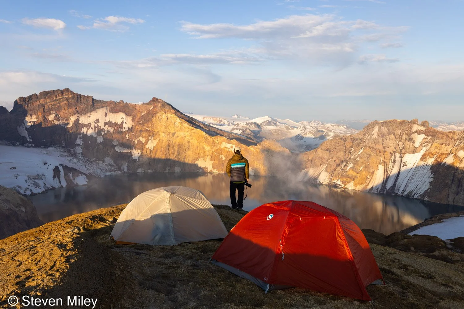
Our campsite on the Mount Katmai caldera rim.

Ryan and I dropped our packs on the peak and ate lunch before scouting the nearby rim for a bit. We collected snow in our water bladders to melt in the afternoon sun and rested most of the afternoon, waiting on the sunset light for photos. Despite my reluctance, we pitched our tents right on the peak in a scenic but very exposed location. To be fair, it would have been difficult to find a less exposed spot anywhere on the rim. But the glorious sunny weather didn’t portend any problems in the near future.

As the light turned golden I started photographing around the rim, hiking up and down a rib leading into the crater with my sore legs complaining every uphill step. Ryan took some cool telephoto shots of me overlooking the lake below. We kept shooting into blue hour, then crawled in our tents and cooked dinner as the light slowly faded. I waited patiently for darkness to set in, hoping the aurora would cooperate later that night.

When I emerged from my tent later I couldn’t believe my eyes. Lights. Several of them. Visible all the way from Kodiak Island & Afognak Island to the east. I shouldn’t have been surprised to see them considering I was on top of a mountain with a direct line of sight to the islands, but in all the planning, mapping and visualizing I did before the trip I never imagined I’d have to avoid photographing artificial lights in such a remote location. But a dull glow over the true peak of Mount Katmai to the north signaled a developing aurora, so I forgot about the light pollution and descended with Ryan down the rib with my camera gear and a headlamp. Because we were so far south I was hoping we’d reach geomagnetic storm levels so the aurora would reach high enough in the sky for some incredible reflection shots, but we received a more modest display that reached just above the peak of Mount Katmai. I might have caught a slightly better reflection from the south rim, but I’ll just have to try again one day for the spectacular crater lake aurora photo I have in mind.
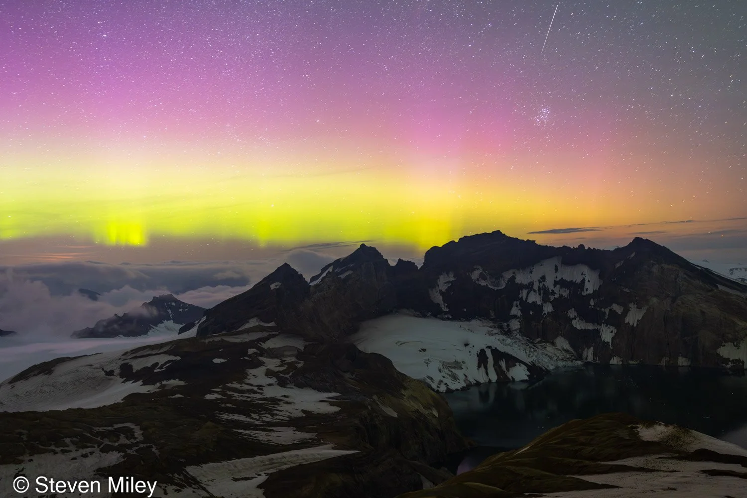
Aurora with a meteor over the Mount Katmai Crater Lake.

After the aurora faded I went to sleep. Clouds encapsulated Mount Katmai overnight and in the morning the conditions were near freezing with zero visibility and a light drizzle. I thought the clouds would burn off later in the day, and they did start to part for about five minutes later in the morning, just long enough to glimpse the crater lake and a few patches of blue sky. But the clouds quickly enshrouded the rim again and a steady light rain fell for the rest of the day. I talked Ryan into staying on the rim for one more night rather than camping lower since the next day was supposed to be sunny again and we could easily hike all the way back to our pickup spot in one day heading downhill. To combat boredom, we hiked counterclockwise around the rim across the snowfield between our camp and the sister peak next to us. The visibility didn’t improve at all on the other side and we couldn’t see anything more than 100 feet away, which was a shame because I wanted to scout the south side of the rim for good vantage points or a potential route to the water below. After we returned to our camp the rain finally subsided and the clouds retreated away from the caldera back down the Valley of Ten Thousand Smokes, but the prospect of clear skies for the aurora seemed low so I went to sleep.

I awoke in the middle of the night to a gentle slap on the head. After a brief moment of confusion in the darkness, I realized strong wind gusts were whipping my tent and threatening to collapse it. I braced my tent wall with one arm and held down the fly that had come loose with my other. I shouted to Ryan to ask if he was OK and he shouted back his tent was holding up so far but he was also bracing his against the wind. The gusts had to be 35mph or stronger. A dull light flickered as Ryan turned on his headlamp and pointed it around. He yelled, “Should we pack up and head down?” I shuddered at the thought of stepping outside into the cold wind and trying to take my tent apart in the dark without anything blowing away. But if the wind worsened or stayed like this much longer we would have to. “Let’s wait 10 minutes and see if it dies down!”

After what seemed like an eternity of awkwardly holding onto my tent, though it was probably only 15 minutes or less, the wind gusts steadily became noticeably weaker. We cautiously held onto our tents until they stopped shaking violently and the sound of the wind rushing over the rim faded. As suddenly as the wind arrived, it disappeared and we both jumped out of our tents to tighten the stakes. Luckily, no tent poles snapped and the fly remained intact. Stars twinkled in the darkness but there was no glow from the aurora. We considered if we should pack up and head down the mountain in the dark, and agreed to do so if the wind returned. I crawled back in my sleeping bag and nervously perked up my ears every time a gentle breeze rustled my tent until I passed out.
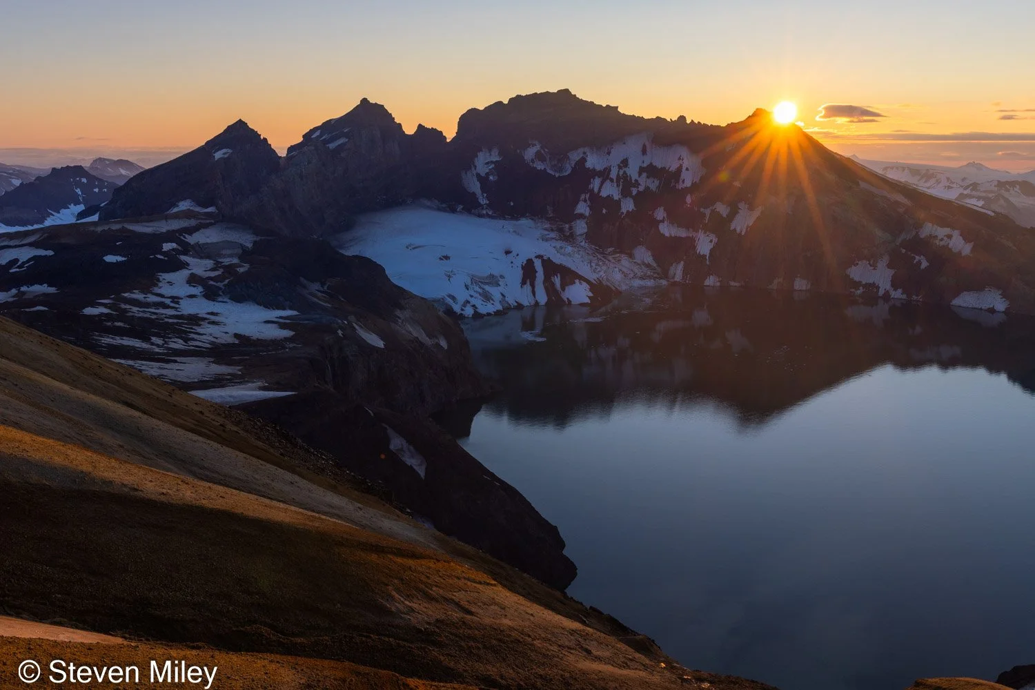
Mount Katmai Crater Lake at sunrise.

I awoke just before sunrise. I could hear Ryan walking around outside and when I asked what the weather looked like he simply said I should come outside with my camera. When I unzipped the flap on my tent the entirety of the crater lake was visible below and the clouds had disappeared. The sight felt strange after spending the previous day in a cloud and nearly being blown off the mountain just a few hours earlier. I scampered around the rim with my camera to catch the sun as it crested Mount Katmai and the snow on the glacier below turned pink.

After eating breakfast, we packed up and began descending the mountain. We practically ran down the ridge on the soft ash. The mountains cast dramatic shadows over the valley in the early morning light while the fog in the lower valley slowly crept away downhill.
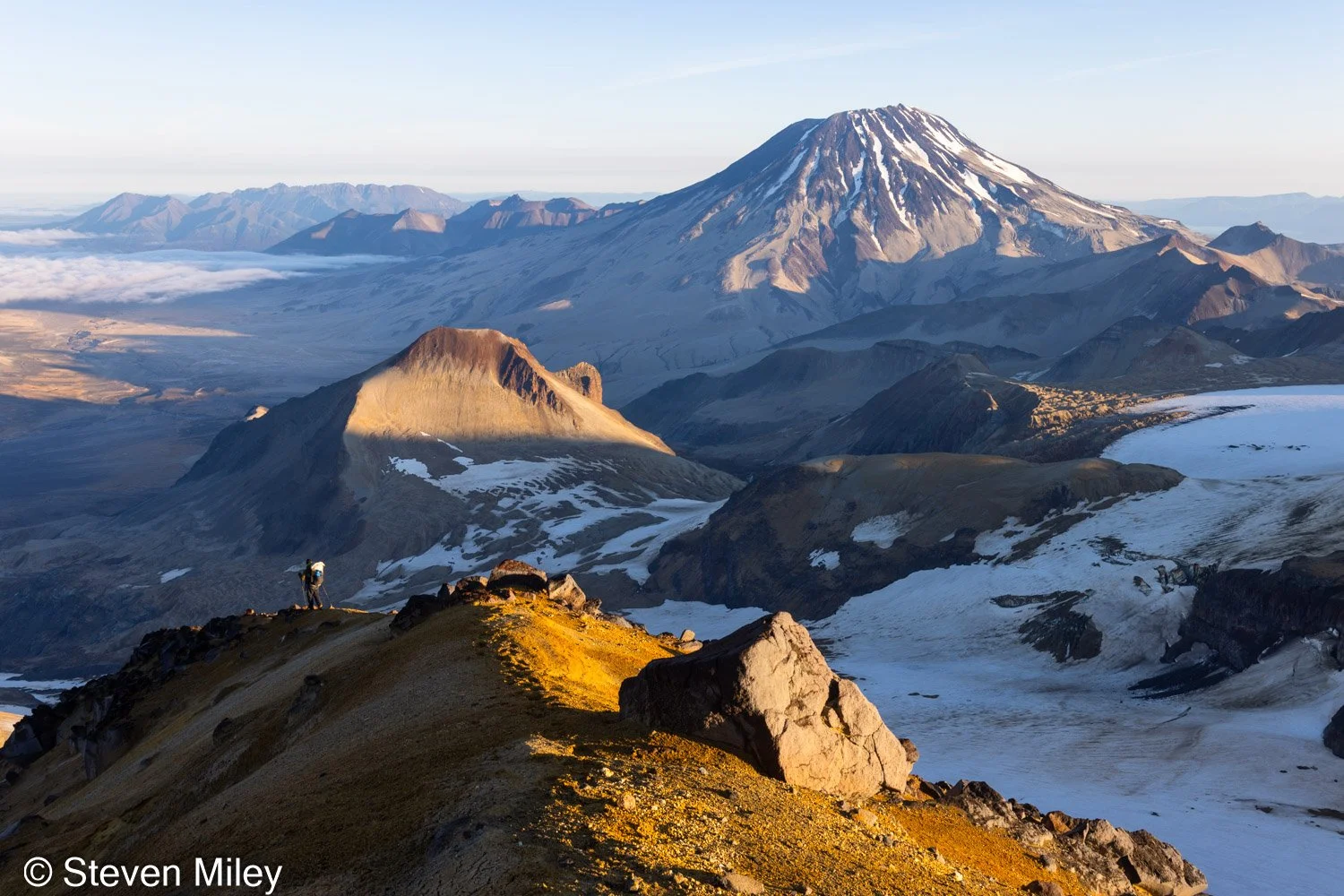
Descending from the Mount Katmai caldera. Mount Griggs is on the upper right and Whiskey Ridge is in the sun at center left.
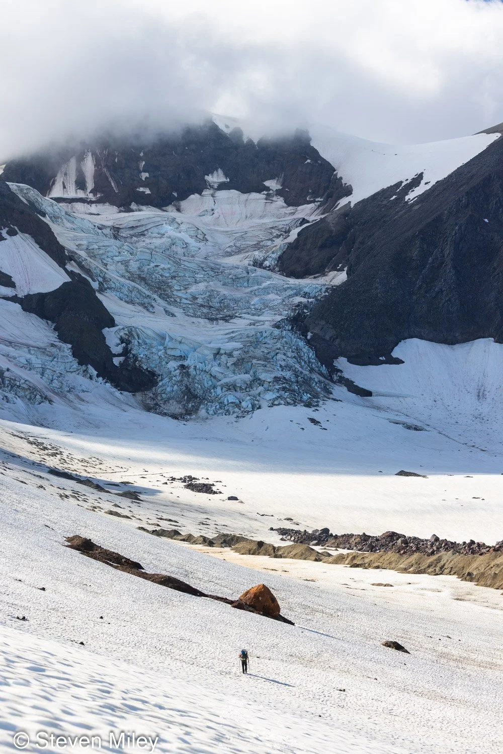
View of the icefall on the NE flank of Trident Volcano as Ryan crosses one of the Knife Creek Glaciers.

As we reached the head of one of the Knife Creek Glaciers, Ryan and I decided to take a shortcut across the upper glacier to avoid navigating the messy ash-covered lower glacier and losing significant elevation. From our high elevation we could see a reasonably clear path across the glacier but we still anticipated hitting a few obstacles. We traversed across the névé on the steep upper glacier to a gentle slope beneath an impressive icefall where we had to circle around the tails of a few rocky moraines. Just when we thought we were going to cruise the rest of the way across the glacier back to Novarupta, we encountered the telltale linear sag in the snow of a crevasse intersecting our path. When I hiked near this area in 2017 most of the snow had melted off the ice of the glacier so it was easy to spy any problem areas from a distance and avoid them, and the problem areas were quite few and isolated. This crevasse and a few others running parallel beyond it were still obvious, but they had been hidden from view by the moraines on the glacier until we reached them. Only two of them were still completely bridged by snow, while the others were melted enough to find easy crossing spots. Each crack seemed to extend quite far upstream and they continued over a steep dip in the glacier downstream, so it wasn’t practical to walk around them. After some consideration, we decided to cross the snow bridges since they were narrow and still solidly frozen. I tested the integrity of each snow bridge with my poles and then spread my weight out on my poles and legs as I hopped across with Ryan following behind me. Ryan had tied a piece of thin rope around me (only slightly better than paracord) with the idea that he could tug me backwards if I started to fall in, but luckily we didn’t have to test its tensile strength.

After passing the crevasses, we climbed over a couple of rocky moraines before we reached the edge of the glacier. The bottom of the slope bordering the glacier was quite steep and difficult to climb as it was covered in loose ash on top of firm snow. (Wind tends to pile ash in the same places it piles snow in winter.) A few steps up and the ash would give way and down we’d go. After a few tries we finally reached solid ground and the hard part of our trek was over.

Once off the glacier, we began climbing over a small hill when a bull caribou appeared on top just a few dozen yards ahead of us. The caribou posed long enough for us to capture some nice shots before it disappeared over the other side of the hill. When we crested the hill we spotted the caribou again ambling away toward Novarupta, already a significant distance from us. As we continued, the stunning Mount Mageik came into view, heavily draped in snow and glacier ice. Our caribou friend was kind enough to pose in front of Mageik on a saddle before disappearing for good.
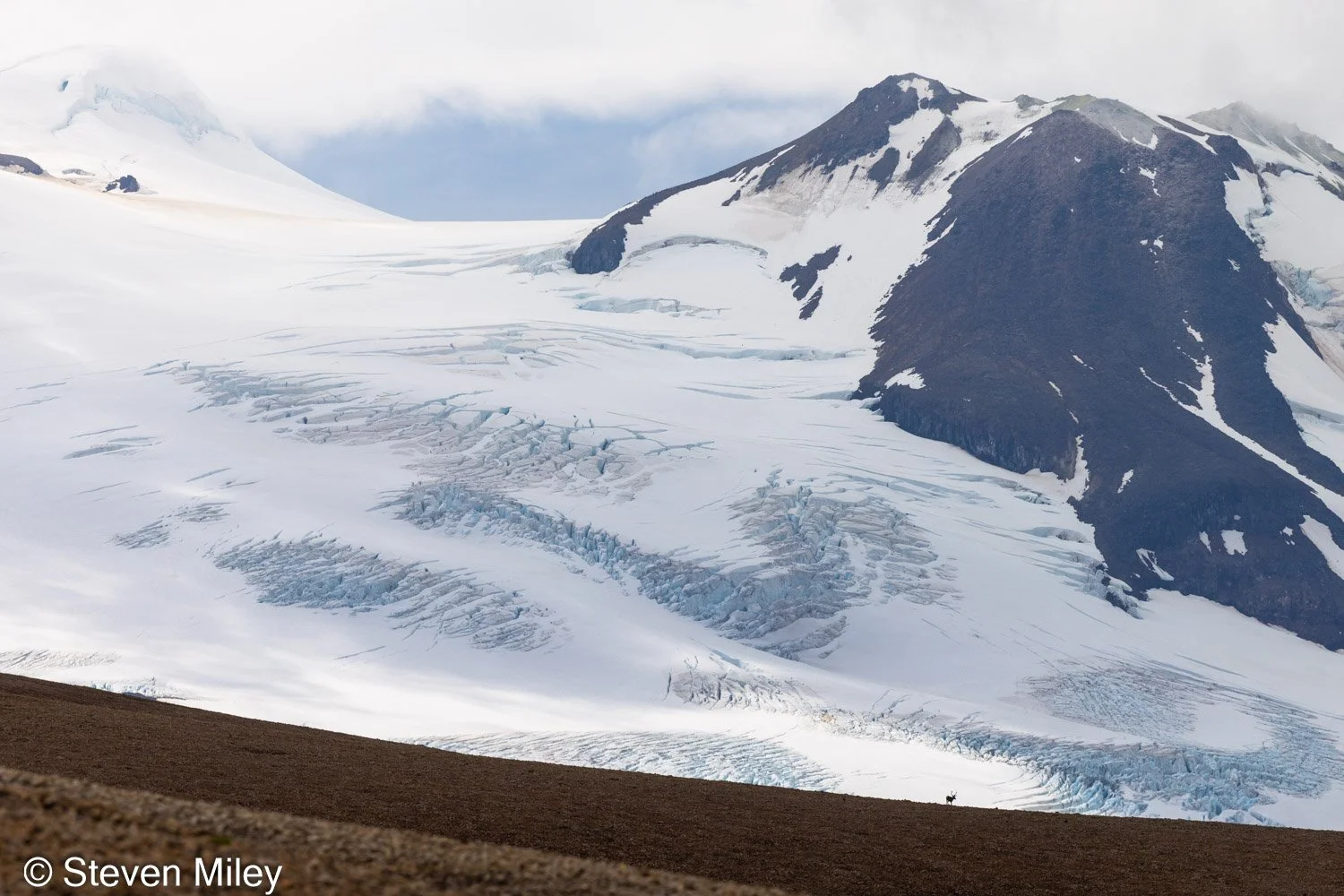
View of Mount Mageik with a bull caribou in the foreground.

We paused to rest on the upstream side of Novarupta. There’s a nice flat spot here with a stream running through it, one of few places in the entire valley where you can find clear running water late into the summer or any significant vegetation. Caribou tracks crisscrossed the ash and mud here. I went for a short walk sans backpack while Ryan tried to contact our pilot to see if he could pick us up that afternoon. I marveled at some of the colorful rocks scattered around the area and studied nearby Falling Mountain, which I had half-planned on climbing for a photo if the opportunity arose. When I returned to our rest spot, Ryan told me the pilot couldn’t pick us up until the next day, so after some consideration we decided to leisurely walk the rest of the way to the pickup spot and camp nearby so we could leave as early as possible in the morning. I didn’t have anywhere to be, but Ryan had to get back to his out-of-state job and was a bit anxious about missing his flight out of King Salmon.

The early evening sun cast Baked Mountain in a golden glow as we hiked steadily downhill beside it toward the pickup spot. I had memorized some of the features on the mountains along the edges of the valley near the landing site to help triangulate it on the return because the local terrain was as featureless as a flat desert, but I still needed to rely on GPS to find it. We camped close by along the edge of River Lethe, where I was surprised to see a vole scurrying along the bank. There were more caribou tracks here as well, and some bugs flying around. There were also some old footprints from two other people who had crossed the river nearby before we arrived. Suddenly, the valley seemed much less lifeless.

In the morning, King Salmon was fogged in so we had to wait until it cleared for our pilot to pick us up. We waited, and waited, and waited. A couple small planes flew up the valley and each time we became excited only to be disappointed when they turned out to be the wrong plane. Ryan paced anxiously while I lounged on the ash, alternately taking off and putting on my jacket as the sun poked in and out of the clouds. We walked along River Lethe to kill some time, but I left my camera behind so I don’t have any shots of the river or the canyon it flows through to share. There were very few spots along the canyon where escape looked possible for anyone stuck in the water, and several locations where death looked certain. Our pilot told us it’s easier to sink in the water due to the suspended volcanic ash lowering the density. Not sure if that’s true, but I don’t think I’ll ever take a plunge to find out.

At last, our pilot arrived and we returned to King Salmon where we celebrated with some obligatory post-adventure burgers. I flew back to Fairbanks that evening and I brought plenty of volcanic ash home with me in my hiking boots and backpack. I even found some ash in my Jetboil the next time I used it months later. The Mount Katmai Crater Lake has officially been crossed off my Alaska bucket list, but I still plan to go back again someday, preferably sooner rather than later.
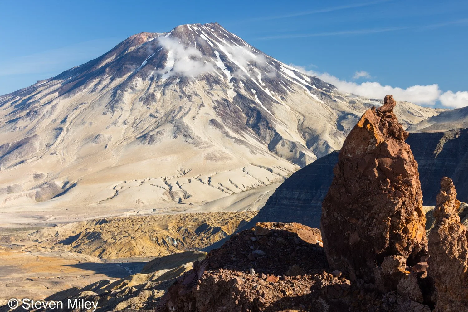
View of Mount Griggs from high on one of the Knife Creek Glaciers.

Katmai National Park August 2017

 
The Buttress Range along the western edge of the Valley of 10,000 Smokes in Katmai National Park, viewed from the side of Baked Mountain.

The Buttress Range along the western edge of the Valley of 10,000 Smokes in Katmai National Park, viewed from the side of Baked Mountain.

When I stepped out of the bush plane and felt my foot sink into the ash and pumice, I instantly knew I was in a different place. It looked like a desert except for the blue glacier ice and waterfalls spilling down Mt. Mageik in the distance. And, unlike the desert, the breeze was cold. I was standing in the Valley of 10,000 Smokes in Katmai National Park, a land still recuperating from the devastating eruption of Novarupta in 1912. Some 25 or 30 miles away, tourists were crawling over each other trying to get shots of brown bears catching salmon. But I had this intriguing desolation all to myself, and I wouldn't see another human until my pilot returned to pick me up six days later.

After the plane took off, I began shuttling my gear to the nearby Baked Mountain Huts, a pair of huts located half-way up Baked Mountain in the heart of the valley. The huts were built in 1965 and occasionally serve as a camp for researchers, but they are available to the public for free on a first-come, first-serve basis. I passed several fragments of the huts on the side of Baked Mountain as I climbed up the slope (a sign of the intense weather frequently seen in the valley) and I sincerely hoped "blowing pumice" would not be in the forecast during my stay. I settled into the smaller of the two huts, which was a bit drafty and dark but much more comfortable than sleeping outside in the wind. With the huts as my base camp, I planned to visit the Mt. Katmai caldera and its impressive crater lake, and I also planned to spend time backpacking outside the valley on the other side of Katmai Pass where few people venture.

The smaller of the Baked Mountain Huts. Four beds, a table, storage space, and even electrical outlets if you happen to bring a generator. 

The smaller of the Baked Mountain Huts. Four beds, a table, storage space, and even electrical outlets if you happen to bring a generator. 

The next day dawned sunny and warm, and I took my time soaking in the exotic landscape as I hiked to the base of the Knife Creek Glaciers with a heavy backpack. I followed a social trail most of the way from the huts to the saddle between Baked Mountain and Broken Mountain, where I gained a sweeping view of Novarupta and the colorful valley surrounding it. The slope to the valley floor below was steep, but I practically ran down it on the soft ash. As I circled the rim surrounding the lava dome of Novarupta, I spied steam escaping from some boulders at the dome's base and naturally had to investigate. The steam was warm and carried a pungent smell of sulfur, but I couldn't see the fissure beneath the rocks from which it emanated.  

The lava dome plugging the Novarupta vent. Steam still wafts from various places on the dome.

The lava dome plugging the Novarupta vent. Steam still wafts from various places on the dome.

I continued over rolling hills of pumice and ash. Deep cuts carved into the landscape by snowmelt presented annoying obstacles, but they paled in comparison to the gorges carved into the valley floor by the River Lethe and Knife Creek which I saw from overhead on my flight in. (Harrowing jumps over those gorges are typically the crux for people who hike into the valley from the Three Forks Overlook.) The vast emptiness was contradicted by ubiquitous human footprints, but there wasn't a person to be seen. Clouds draped the peaks of Mt. Katmai and Trident Volcano, which steadily grew larger as I approached. After one final hill, the Knife Creek Glaciers came into full view, sprawling over the valley floor in a jumbled, ash-covered mess. 

The water discharging from the nearest glacier was filled with sediment, but there was snow hiding under wind-blown ash near its terminus. I scraped the ash off with my ice axe and scooped snow into my water bladder, which carried me through the next morning until I found clear running water higher up on the glacier. As the sun began to set, I pitched my tent in a quiet canyon near the foot of Whiskey Ridge with the glacier just a few dozen feet away. Incredible scenery with no people, no bears, no mosquitoes, and no wind...my kind of campsite!  

The eastern summit of Trident Volcano rises above one of the Knife Creek Glaciers near sunset. 

The eastern summit of Trident Volcano rises above one of the Knife Creek Glaciers near sunset. 

The next morning was overcast, but I thought the clouds swirling around the summits of Mt. Katmai and Trident Volcano would thin out later in the afternoon like they did the previous day, so I started following my planned route to the Mt. Katmai caldera. I’ve hiked over several rugged glacier moraines before, but the Knife Creek Glacier below Trident Volcano was on another level. Simply finding a place where I could start ascending the glacier was difficult, and I felt like a rat in a maze as I found my way around dead-ends and clawed my way over steep slopes of ice covered in loose ash. Eventually, I reached the bare ice beneath the eastern summit of Trident Volcano, where I found bright yellow-green olivine crystals sprinkled over the surface. When snow-filled crevasses began squeezing my path, I started following the ash-covered ice to my left, crossing a few hard-packed snowfields on my way to the pass between Mt. Katmai and Trident Volcano, which remained obscured by clouds.       

Ascending a steep section of ice between Trident Volcano and Mt. Katmai. The view is looking WSW toward East Trident. 

Ascending a steep section of ice between Trident Volcano and Mt. Katmai. The view is looking WSW toward East Trident. 

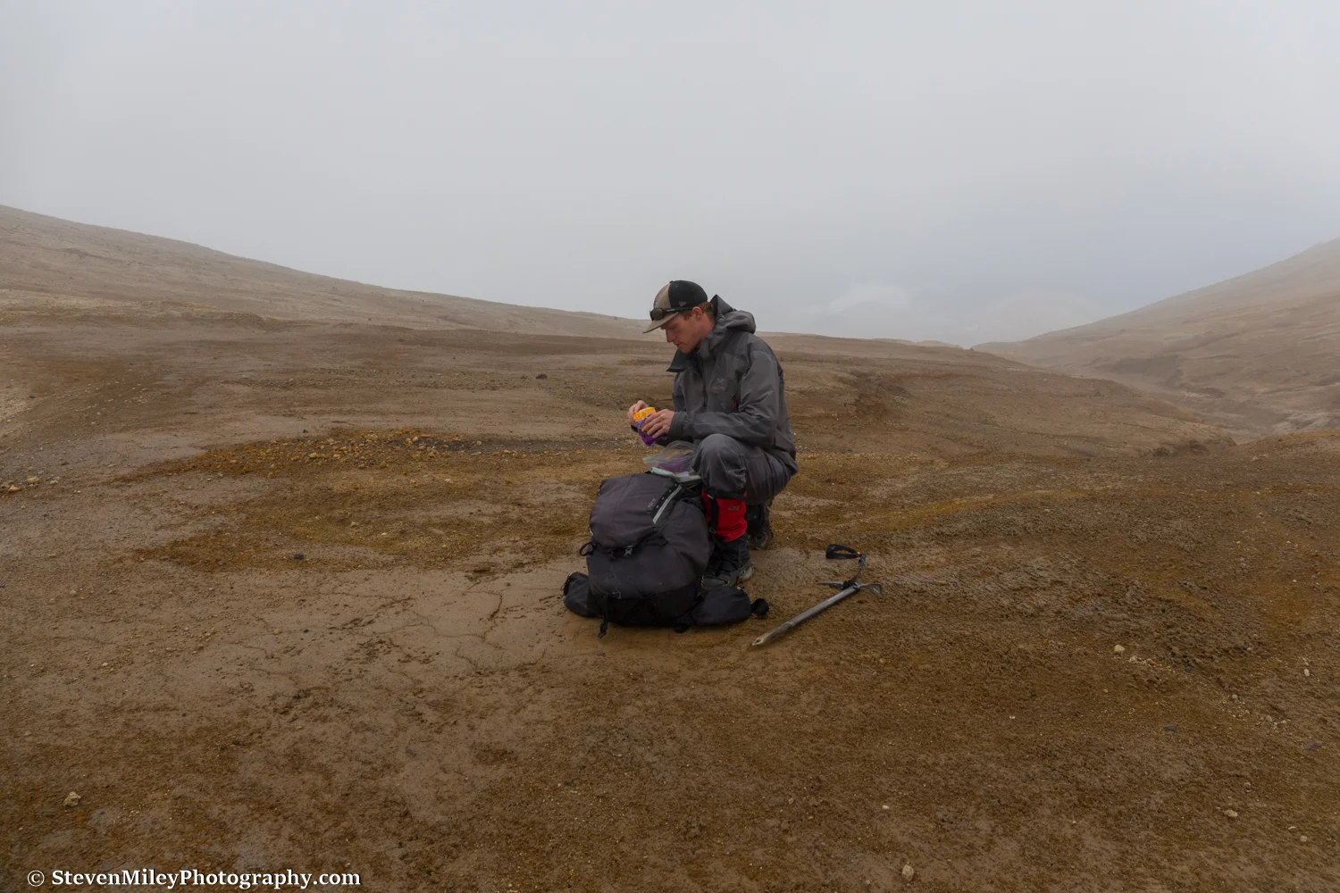
After I entered the clouds, I couldn't see much more than a few hundred feet in any direction. I reached the pass and took a break to eat some cheese and chocolate chips. From there, I had hoped to have a good view of the ridge leading to the peak on the western rim of the Mt. Katmai caldera (elevation 6128') and climb it if it looked manageable, but even though the ridge was right in front of me I couldn't see it. I switched to my backup plan, which was to cross over the pass and hike up the gentle slopes on the south side of the caldera the next day if the weather improved. (The usual route people take to the caldera follows one of the other Knife Creek Glaciers, but that route features crevasse danger and it looked much less pleasant in early August in person than in pictures I had seen of it taken in early summer with more snow cover.)

Pausing for some cheese at the pass between Trident Volcano and Mt. Katmai. The rounded top of Broken Mountain is barely discernible through the clouds to the right of my head.

Pausing for some cheese at the pass between Trident Volcano and Mt. Katmai. The rounded top of Broken Mountain is barely discernible through the clouds to the right of my head.

I began descending from the pass down the Wishbone Glaciers (what's the with the plural names, Katmai?) and quickly realized visibility wasn't improving as I had expected it would. The glacier also turned out to be far less benign than I had hoped. Hard-packed snow still blanketed much of its surface, and even though I felt comfortable sticking to the edge of the snow near the ash-covered moraines, there were gaping crevasses (and I mean gaping) crisscrossing the glacier on my left that dissuaded me from drifting over the snow toward Mt. Katmai. Traveling along the gnarled moraines didn't seem perfectly safe, either, as some of the crevasses that extended into the moraines were partially covered by ash bridges, and several small ash "sinkholes" I passed made me worry that one might open up at any time beneath my feet. With no landmarks available for route-finding and no way to see problematic terrain in advance, my progress was incredibly slow, and I soon found sunset approaching with no idea when or if the glacier might mellow out below. I started working my way toward the western edge of the glacier, climbing over hill after hill and taking circuitous paths around nasty crevasse mazes.

Suddenly, a mountain slope emerged from the mist in front of me. It was the edge of Trident Volcano. I crossed to the bottom of the ash-covered slope and followed it along the edge of the glacier until I found a flat spot where I could place my tent. Looking up, I could just barely see a ridge topped with craggy volcanic rocks leading up into gray nothingness. Looking around, I noticed several of those rocks had toppled down the slope and landed near my chosen campsite, so I set up my tent behind the largest boulder and hoped it would block anything that might tumble downhill while I slept.

I awoke later that night to the steady pitter-patter of rain on my tent. I shifted in my sleeping bag and heard the sloshing of water at my feet, and when I looked I saw a small puddle forming on the floor of the tent. Great, my tent is leaking. My sleeping bag seemed dry enough (except for my toes), and since there wasn’t anything I could do about it, I went back to sleep.

When I rose in the morning it was still raining. I glanced outside the tent and the visibility had deteriorated even further. Drips of water were slowly but steadily falling from the roof of the tent and my sleeping bag was damp. I waited an hour or two to see if the weather showed any signs of clearing, but there was no change. I reluctantly gave up on climbing to the caldera and decided to traverse the south side of Trident Volcano to Katmai Pass, where I expected to find drier weather or at least better visibility in the Valley of 10,000 Smokes. 

Hiking over the unfamiliar, extremely rugged terrain in poor visibility proved very laborious. I generally erred on the side of maintaining or increasing my elevation since I knew somewhere down below there were cliffs, creeks and glaciers that I wanted to avoid, and keeping the incline of the volcano to my right helped me stay pointed in the right direction. I still had to cross one narrow ash-covered glacier, which featured several steep hills of ash that I used my ice axe to help ascend. At one point, I stumbled into the fumarole field on the southern flank of Trident Volcano. I felt like I was walking on an alien moon as steam issued from yellow-green splotches on the ground all around me. I had read a paper before my visit that mentioned the volcanic gases in this area posed a potential danger to people, but the wind was blowing heavily so I didn’t think there would be any risk in continuing forward. I paid close attention for any signs of bodily distress, but I experienced no problems other than the overwhelming rotten-egg smell of sulfur forcing me to breathe through my mouth. Just in case the air was indeed toxic, I decided not to stop for a picture, which I regret because the scene was easily the most outlandish I've ever laid eyes upon. Oh, well—the image in my head will still haunt my dreams forever.

Moss grows beside a stream emerging from the lava flow on the southwest side of Trident Volcano. 

Moss grows beside a stream emerging from the lava flow on the southwest side of Trident Volcano. 

I continued circling around Trident Volcano, anxious to find a landmark. After what seemed like hours of turning slightly right and wondering if one of the shadowy bear-sized boulders that kept appearing out of the mist might turn out to be an actual bear, I finally hit the lava flows on the southwest side of the volcano, which were deposited over the years 1953-1974. Hiking over the slippery, sharp volcanic rocks would have been slow and treacherous, so I was forced to detour miles around them and give up quite a bit of elevation. I soon began seeing caribou tracks, the first tracks of any kind I had seen for two days. Then I saw something really striking: green vegetation! A stream emanating from beneath one of the lava flows had given life to moss and shrubs that appeared neon green against the drab landscape enveloped by the gray backdrop. I thought the stream might be warm, but when I reached my hand in it was unpleasantly cold. I stepped over it and quickly encountered several more streams which flowed over vivid orange rock. The vegetation near the streams became heavy, and so did the bear tracks. I encountered fresh bear scat and began to shout as I walked to avoid a surprise encounter.

When I neared the base of Mt. Mageik, the clouds lifted just enough that I could see the way forward would require a couple stream crossings before opening into a wide plain between the bases of Mt. Mageik and Trident Volcano. Bear tracks and trails were everywhere. I crossed two swift, knee-high glacial streams, and I thought after that I was nearing Katmai Pass until I checked my GPS coordinates against my map—I still had three miles and 1000 feet of elevation gain left! And there were only two hours before dark! As I gained modest elevation walking over the plain, the clouds once again engulfed me and I began relying on my InReach to point me north since every direction looked the same. For a brief moment a skinny white object appeared about a half-mile away near the lava flows to my right, but the clouds quickly snatched it from view. Was it a person? A tent? A cabin? As much as I wanted it to be an opportune shelter, I assumed it was most likely a seismic monitor or some other scientific instrument, and I continued on without investigating it. 

I crossed another sizable creek (perhaps the main branch of Mageik Creek) and followed it upstream into a valley where I began angling up the western side. When I reached an elevation equivalent to Katmai Pass, the clouds were still thick around me and the wind was blowing like crazy, and it was starting to get dark fast. My rain jacket had "wetted out" and my inner layers were damp, and I definitely couldn't rely on my drafty tent and soaking sleeping bag to keep me warm. Yet, dire as the situation may have seemed, I reasoned my worst case scenario was hiking all night in the dark to stay warm. It would at least get me to the peanut M&Ms I left at the Baked Mountain Huts sooner. 

It grew dark to the point where I started using the screen of my InReach as a flashlight in between checking it to make sure I stayed heading north. The creek running in the valley below finally caught up to me and I crossed it, and I knew Katmai Pass was incredibly close. I could only tell I had crossed the pass after I noticed I had been walking at a slight downhill incline for a lengthy time, and, disappointingly, the weather showed no sign of improving. I started following a dried up stream bed knowing it could only lead downhill, and it eventually brought me to a miniature slot canyon carved into the ash and pumice. The canyon provided the shelter from the wind I needed, so I hopped inside and used the rain fly of my tent to protect me and my pack from the light drizzle. I managed to stay marginally warm and may have even caught an hour of sleep while I waited for sunrise.

When daylight returned, I peeked over the canyon wall and couldn't have been more delighted to see Baked Mountain straight ahead. The clouds had lifted! I realized I had taken shelter between Falling Mountain and Mt. Cerberus without knowing either mountain was beside me. The weather still looked awful over Katmai Pass behind me, and the wind was still blowing fiercely, but there was sunshine in the Valley of 10,000 Smokes and I started hiking toward it like a moth to a flame. 

Drying out my sleeping bag and sweatshirt on the larger of the Baked Mountain Huts. 

Drying out my sleeping bag and sweatshirt on the larger of the Baked Mountain Huts. 

Back at the Baked Mountain Huts the sun was shining and the wind was blowing. I changed into dry clothes and hung my gear outside to dry. Completely exhausted, I relaxed at the huts for the rest of the day and read through a number of the logbook entries from the 1996 - 2006 era. (The most recent logbook volume apparently suffered water damage and was illegible.) A few entries detailed trips on the other side of Katmai Pass, and the descriptions of the terrain left me longing to go back from where I had just come—in better weather. I went to bed early that night before howling wind and rain arrived. 

Caribou tracks and an odd patch of glacier ice near East Mageik Lake.

Caribou tracks and an odd patch of glacier ice near East Mageik Lake.

On my last full day in Katmai National Park, I set out to see the Mageik Lakes, a pair of lakes about a mile apart near the base of Mt. Mageik. I started descending Baked Mountain only to realize a few hundred feet down that I left my camera behind. My legs complained heavily as I climbed back up the slope to fetch my camera, and I knew I'd be crawling my way back to the huts later. I crossed the valley floor with the wind blowing in my face, watching the low clouds drift over the lakes in the distance and hoping the rain would hold off as I plodded past colorful extinct fumaroles. I walked beside the River Lethe for a stretch where it flowed even with the valley floor rather than in a deep canyon, and in that form it looked no more intimidating than any of the other glacial creeks I've waded across.

I made it to the edge of the eastern lake just as light drizzle began falling. A medium-sized waterfall and a couple smaller streams originating from glacier ice on the northern slopes of Mt. Mageik above fed the lake, and it discharged into a 10-foot deep canyon. I walked to the end of the canyon looking for a good crossing spot, but the rain intensified and started hammering the other lake, and I was forced to give up on seeing it and its more impressive waterfalls. The rain finally cleared as I slowly climbed up Baked Mountain back to the huts, and I was treated to one of the better sunsets I've seen this summer.

Perfect weather graced my final morning in Katmai. Heavy fog filled the lower valley, but in the other direction I could finally see the entirety of Mt. Mageik, whose upper half had remained concealed during my entire trip. The dark clouds swirling over Katmai Pass behind Mt. Cerberus were gone, and the jagged peaks along Mt. Katmai's crater rim were completely unobscured. The wind had completely disappeared. I was disappointed I wouldn't get to enjoy hiking on such a nice day, but at least I didn't have to worry about my pickup being delayed by bad weather.

Morning fog blankets the lower Valley of 10,000 Smokes.

Morning fog blankets the lower Valley of 10,000 Smokes.

I decided I was only making one trip to carry my gear down to the valley floor. I put everything that could survive a good tumble into my duffel bag, then rolled the bag and my tent down the side of Baked Mountain. I carried the rest of my gear down in my backpack and retrieved my duffel bag and tent near the bottom, then found a good landing spot for the plane and made a windsock with my ice axe and a roll of toilet paper. While I waited for the plane, I carried a wash cloth and a clean shirt to the River Lethe and tried to clean up as best I could before returning to society. The plane arrived right on time and I climbed in, sad to leave but anxious to get a hot meal in King Salmon. 

I barely scratched the surface of the volcanic backcountry of Katmai National Park. It's the most unique place I've been in Alaska, and I can't wait to go back...with more food and a better tent!

The Baked Mountain Huts at sunset with Trident Volcano in the background.

The Baked Mountain Huts at sunset with Trident Volcano in the background.