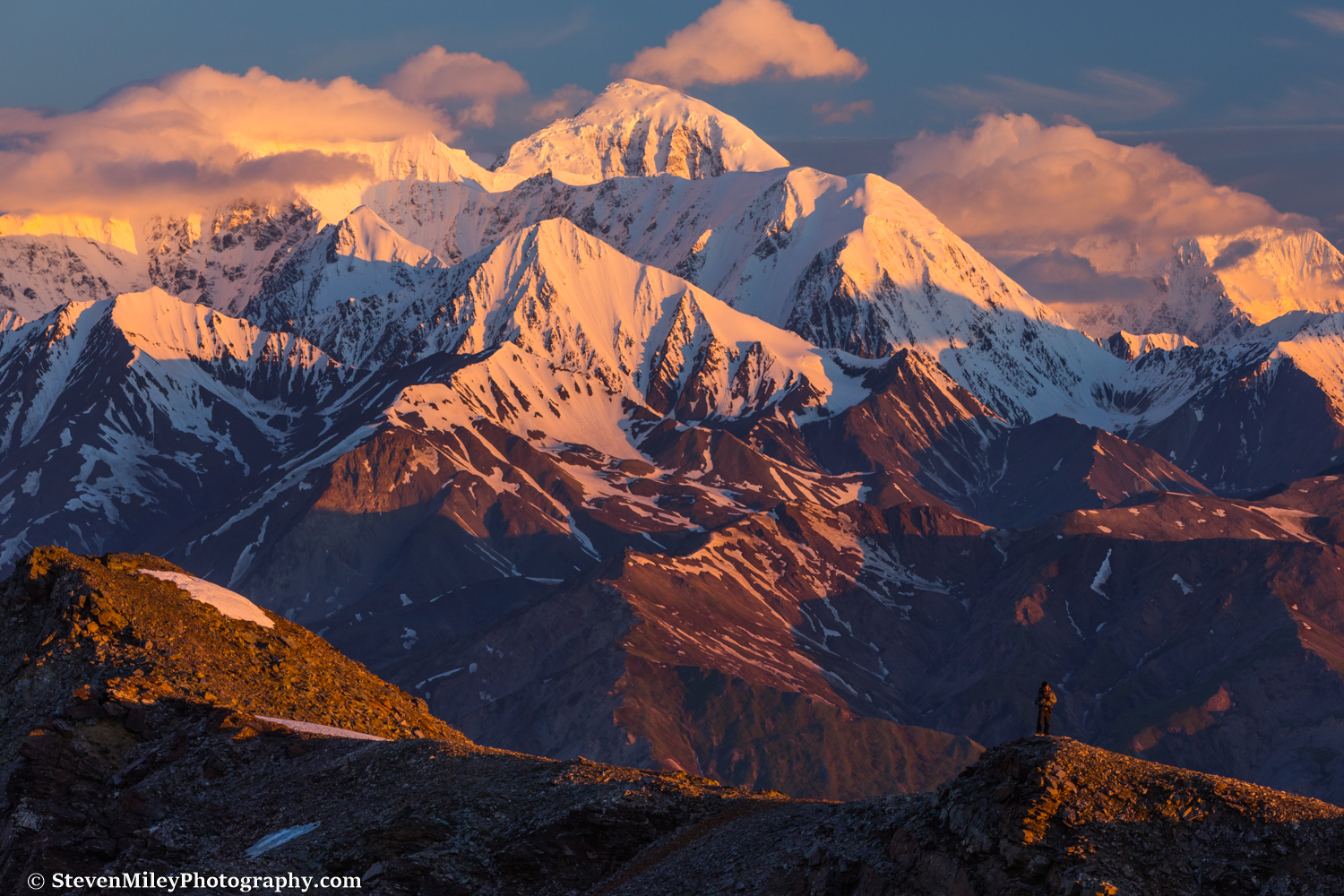
Sunrise on Mt. Moffit (left) and Mt. Hayes (right, behind clouds), viewed from a ridge across the Delta River near Black Rapids.
The "Hayes Range" roughly stretches from McGinnis Peak to Mount Deborah in the eastern Alaska Range and is named after its tallest member, 13,832-foot Mount Hayes. These mountains are some of the most striking and beautiful in Alaska, featuring impressive vertical relief, huge faces, and ice-capped summits. While the Hayes Range commands the attention of anyone driving between Fairbanks and Paxson along the Richardson Highway, these mountains have a distinct lack of notoriety beyond locals, and very few Alaska photographers bother shooting them. This summer I made it my goal to take some inspiring shots of the Hayes Range.
The trifecta of McGinnis Peak, Mt. Moffit, and Mt. Hayes dominates the view as you drive south from Delta Junction. To catch these mountains in optimal light at their closest approach to a road, I climbed a ridge near Black Rapids to position myself for sunrise. The ridge I chose sits sandwiched between two officially unnamed creeks, though one is labeled "One Mile Creek" by a highway sign and the other is labeled "Grizzly Creek" by a pipeline sign. I started hiking up Grizzly Creek before sunset, noting that the flow had increased significantly since May.

Sunset lights up clearing rain clouds over "Grizzly Creek", one of many scenic mountain creeks near Black Rapids along the Richardson Highway.
I turned up a poorly marked hunting trail which led above tree line. After sunset, the sky dimmed slightly but the warm glow of civil twilight persisted on the northern horizon. Around 1:30 a.m. I noticed the sky was starting to brighten again, and soon the clouds hovering above the Alaska Range began glowing shades of pink. I reached my planned vantage point on the ridge above a false summit just in time to catch the alpenglow on the Hayes Range across the river.
Sunrise on the big mountains of the eastern Alaska Range.
I was expecting completely clear skies at sunrise but the clouds swirling around McGinnis Peak and Mount Hayes added some welcome drama to the sunrise scene. As the pink light began turning orange I started hiking higher along the ridge toward the ridgeline separating the Delta River valley from the Jarvis Glacier valley. I stopped at several locations along the way to take some self-portraits using a timer and marvel at the steep cliffs on the south side of the ridge. The view of Black Rapids Glacier was rather impressive as well.
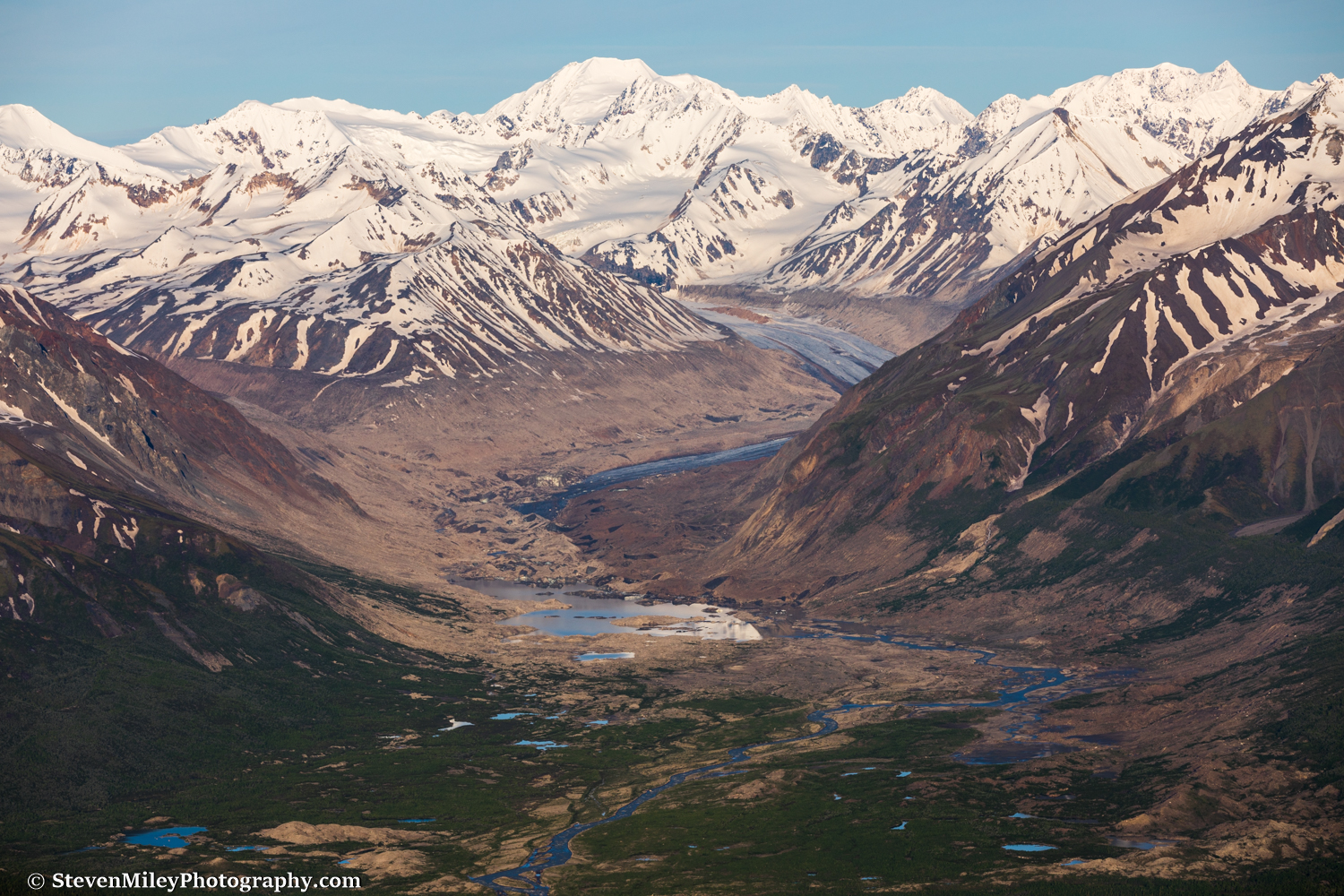
View of Black Rapids Glacier. In winter, I cross the frozen lake at the terminus to explore ice caves and other formations in the glacier moraine.
After climbing roughly 4800 feet Mount Silvertip suddenly came into view and Jarvis Glacier appeared thousands of feet below as I topped out on the ridgeline. At 7:00 a.m. it was definitely below freezing at 7000 feet elevation and I had to put on my heavy sweatshirt while I rested and took in the view for an hour or two. The sun was beginning to warm things up by the time I started descending and the clouds over the Hayes Range had disappeared.

The Jarvis Glacier valley. "Item Peak" is shining in the sun at upper left; the base of Mt. Silvertip is in the shade at left.
On the way down I hoped for a lucky Dall sheep encounter on the ridge, but I only spotted sheep on the ridge opposite Grizzly Creek where I couldn't frame the mountains in the background. I explored a series of waterfalls along Grizzly Creek below the false summit, and there was some lingering ice covering portions of the creek which glowed a captivating aquamarine color from underneath.

Snow-turned-to-ice melts along "Grizzly Creek" with the Hayes Range in the background.
Later this summer I plan to cross the Delta River for more shots of the Hayes Range from close distance. I hope to get at least one perfect day like this while I'm out there.
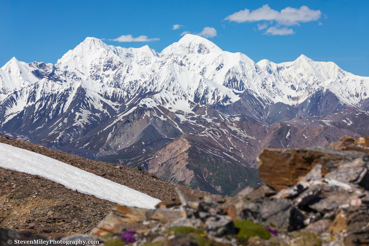
McGinnis Peak (left), Mt. Moffit (center), and Mt. Hayes (right).
Want to hike or photograph here? Grizzly Creek “Trail” is one of my Black Rapids Tours summer offerings.