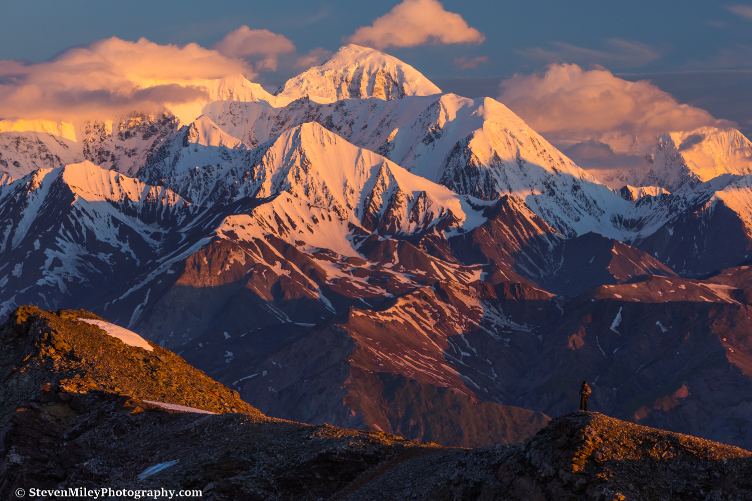
Sunrise on Mount Moffit’s southeast face, viewed from a pass near McGinnis Glacier.
I returned to McGinnis Glacier in early June to photograph the big mountains of the eastern Alaska Range from close distance. McGinnis Glacier is easily reachable in a day, but the Delta River crossing adds extra complexity to the trek and a bit of danger — especially for my camera gear. As I hiked to the edge of the river carrying my pack raft, I spotted bison resting on the far side of the river next to McGinnis Creek. After I floated across, the bison eventually noticed me and moved away toward the brush. I followed the ATV trail on the north side of the creek above tree line, then veered off toward the glacier.
The first time I hiked up McGinnis Creek, I didn’t know the ATV trail existed so I fought through 1000 vertical feet of steep, dense forest.

View of the Delta River looking upstream at the McGinnis Creek crossing point.
I ditched the tent on this trip to save weight. I brought my rain gear and made note of a few places I could shelter along my route just in case, but the weather forecast was good and I planned to hike overnight and sleep during the day, so I wasn’t worried about staying warm. If the mountain weather stayed nice on Day 2, I was considering heading to Trident Glacier as well. If not, I would just head home.
The mosquitoes harassed me constantly as I plodded across the wet tundra. Clouds rolled over the summits of McGinnis Peak and Mount Moffit in the distance, but I expected them to clear later.

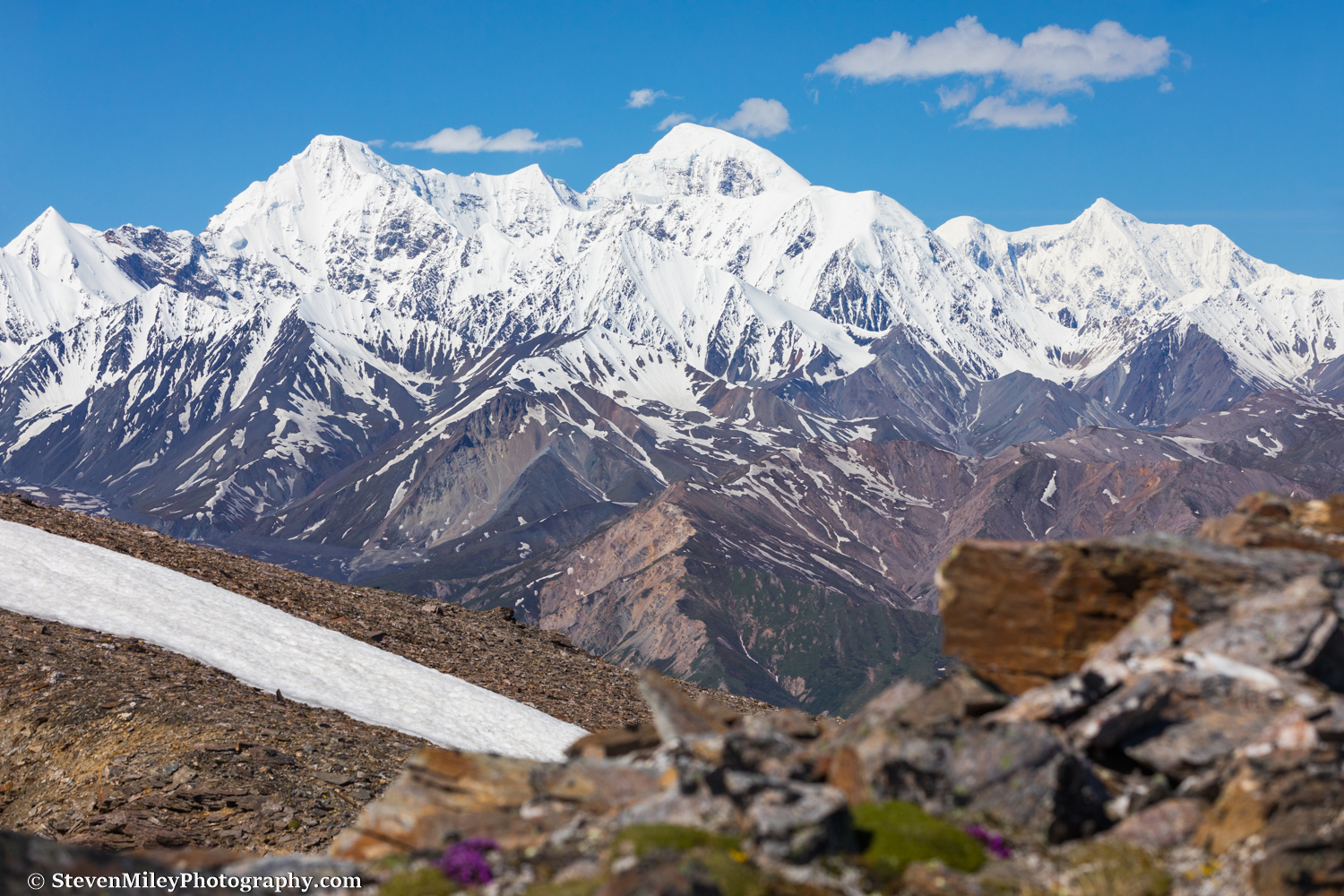
Hiking over tundra toward McGinnis Glacier with McGinnis Peak (left), an unnamed 10K+ foot mountain (center), and Mt. Moffit (right) looming in the distance.
As I gained elevation after sunset I noticed ice forming on the surface of the small tundra puddles. I threw on a pair of light gloves to keep my hands warm, but I stuck with shorts until I reached a pass near the glacier where I put on my heavy layers. Sunrise was still an hour away, but the sun began lighting up the clouds over the horizon well beforehand.

View of Granite Mountain at sunrise. Granite Mountain dominates the southeast horizon from Delta Junction and Fort Greely, sitting across the Richardson Highway from Donnelly Dome.
The clouds over McGinnis Peak, Mount Moffit and Mount Hayes cleared overnight but just before sunrise new clouds appeared in the sky, interfering with the mountain alpenglow. I caught a few good sunrise shots but not exactly what I desired. All the smaller peaks of “the Deltas” were visible (Silvertip, Institute Peak, White Princess, etc.) as well as Donnelly Dome and Granite Mountain across the river, and I even spotted Mount Sanford glowing over 110 miles away to the southeast.

Crisscrossing ridges at sunrise. Mount Moffit is at upper right.
The thick slabs of ice hanging above the steep east wall of McGinnis Peak are quite intimidating when viewed from near McGinnis Glacier. The same goes for Mount Moffit’s massive southeast face. The level of detail visible on these mountains from the Richardson Highway just doesn’t compare.

McGinnis Peak’s summit glows at sunrise.
Patchy clouds moved in and blocked the rest of the early morning light on the mountains. The sun would briefly light up small pieces of the landscape for the next several hours, but the clear, sunny morning I expected didn’t happen. I hiked to the edge of a steep scree slope overlooking above McGinnis Glacier to rest for awhile, hoping the clouds would clear by the afternoon so I could catch some more shots I had in mind.
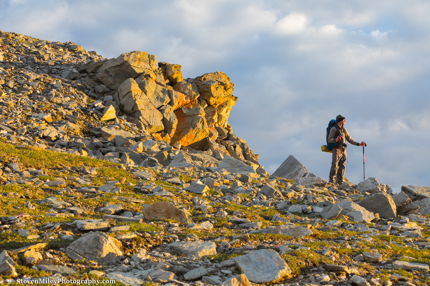
Pausing for a selfie.
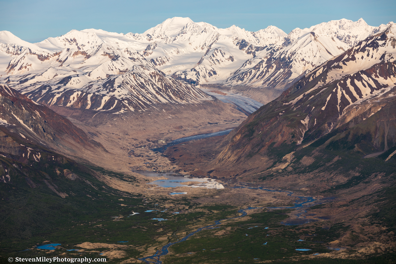
McGinnis Glacier is almost entirely covered by rock debris. I crossed it last summer and it’s one of the most rugged glaciers I’ve traversed.

View of McGinnis Glacier.
I spied about a dozen Dall sheep grazing on the slope a couple hundred feet below me. I watched them cross the scree and play around on a steep rock outcropping, then descend out of view toward the glacier. I began descending toward the rock outcropping when I spotted a ram resting just a couple dozen feet below me near some rocks. He heard me and disappeared quickly down the slope, only to emerge a short time later accompanied by several more rams. They ambled away over the scree and parked themselves on an alpine meadow above the glacier, far out of reach.

Dall sheep ram sporting a full curl.
From my mountain perch I could see the Delta River was bathed in sunshine, but dark clouds were drifting over my location. Soon, light hail started falling and I decided to retreat to the other side of the pass where the sun was still shining. I spotted some caribou on a snow patch about a half-mile away, but they disappeared while I took shelter under some rocks until the hail passed. When I neared the snow patch the caribou suddenly appeared out of nowhere again and they approached me. They passed back and forth closely several times while checking me out, giving me plenty of time to take pictures. They eventually walked away over the pass and I didn’t see them again.

Curious caribou.
The clouds had grown very dark in the direction of Trident Glacier so I nixed the idea of hiking there. I had brought enough food for a few nights but the mountain weather apparently wasn’t going to cooperate with my photography plans, so I decided to hike back to the Delta River. As I hiked down a ridge from the pass the hail resumed, dropping enough pea-sized stones to coat the ground in white. The hail mostly bounced off me so I stayed relatively dry, though it did sting my hands a bit. The sun was still shining on the tundra below and when I made it there I took a nap in some dry grass while the dark clouds continued swirling over the mountains where I had just been. I awoke a few hours later and the weather over the tundra had deteriorated, so I continued to the river and floated back to my car.

Hail on Alaska poppies.
I’m looking forward to floating across the Delta River at least a couple more times this summer.