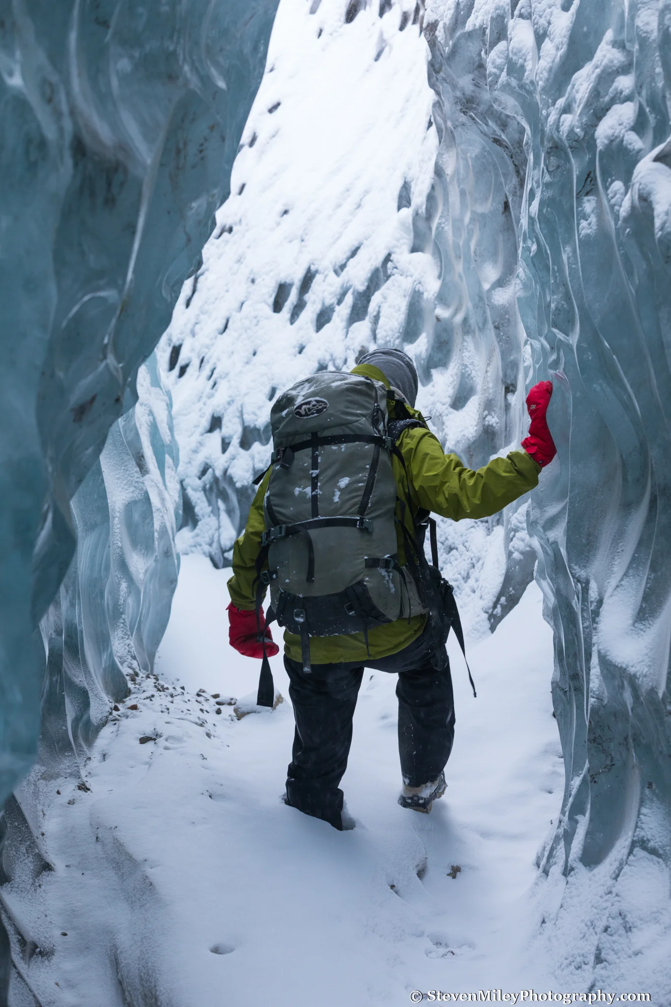
An ice tunnel in the moraine of Black Rapids Glacier.
What a difference a month makes. I hiked to Black Rapids Glacier last weekend after visiting the glacier previously in January and the return of the sun made the hike infinitely more enjoyable and my photographs much livelier than last time. With a merry group of companions I crossed the Delta River early in the morning and started hiking along the glacier creek. We made good time walking on the ice with spikes on our shoes but after a couple miles continuous snow cover slowed our pace, except for my friend Tim who began gliding along on the skis he had carried on his back.
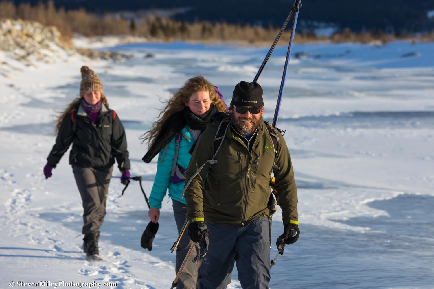
Asia, Gabriela, and Tim hiking along "Black Rapids River". I'm not sure how Tim got ice in his beard so quickly—I suspect he intentionally cultivated his look.
As we neared the terminal moraine we encountered open water, which we crossed via a questionable ice bridge. We could have walked the not-so-long way around but no one in the group thought that sounded like fun.

Crossing open water near Black Rapids Glacier.
None of my friends had visited the glacier before so they were all incredibly awed when they reached the terminal moraine and got to see and feel the impressive blue ice. I knew they would be even more astounded the further they explored. Black Rapids Glacier is a seemingly endless supply of natural ice marvels and it's hard to believe when you're out there that a place so amazing and so easily reachable could feel so wild and untouched.

Inspecting a crack in a giant wall of ice at the terminus of Black Rapids Glacier.
A few barely-perceptible white dots on top of the mountain ridges above us seemed to appear and disappear occasionally: Dall sheep. We passed many animal tracks early in the hike, but once we reached the glacier moraine we only saw one lone set of wolverine tracks crossing the glacier valley.

Wolverine tracks on Black Rapids Glacier.
We paused for lunch atop an ice bulge next to a pointy ice formation that could have passed for an abstract outdoor sculpture. We had fallen into the shadow of the mountain ridge on the south side of the valley, but sunlight steadily crept closer to us along the glacier moraine while we ate. When we resumed hiking we were soon basking in the sun's warmth, a warmth that is sorely missed during the months of November, December, and January in Interior Alaska. I took my gloves off for awhile.

Collapsing ice in the moraine of Black Rapids Glacier.
I decided to lead the group past the ice cave I visited in January and look for new features farther up the moraine. We hadn't walked very far when I spotted a huge ice tunnel nearby. On either side of the tunnel entrance was a tall chasm in the ice, one leading left and one leading right. My companions disappeared in different directions while I broke out my tripod and started photographing.

The entrance to the Black Rapids Glacier ice tunnel.

Barbara at the far end of the Black Rapids Glacier ice tunnel.
We eventually reunited outside the tunnel in the golden afternoon sun with our minds blown. I snapped a group portrait and we continued up the moraine until the sun began to disappear behind the mountains. There was plenty left to explore but we were running out of daylight and energy, so we turned around. As we prepared to go, we heard the SOS beacon beeping in Tim's bag. We had rendezvoused at the Lodge at Black Rapids before starting our hike and the owner had lent us the beacon in case of an emergency. Somehow, hours earlier, one of the beacon's preset messages was sent to the lodge reading, "We need help immediately. Pick us up at this spot." When we didn't respond to their follow-up responses the lodge staff organized a search party to look for us. We sent a message saying we were alright and the search party turned around about half-way to the glacier.

Heading back to the highway under fading daylight.
The stars were just starting to emerge when we reached the Delta River. We broke out our headlamps and crossed the ice, then powered up the final slope back to our vehicles. The lodge staff greeted us with dinner when we arrived and recounted their own adventure trying to "rescue" us. Too bad for them they didn't try to rescue us sooner or they could have seen some of these amazing sights!

The last bit of hiking before reaching the Richardson Highway.
For tips on photographing ice caves, read my post How to Photograph An Ice Cave.
Interested in visiting Black Rapids Glacier or seeing an ice cave? I offer guided winter tours. More information.