I created Black Rapids Tours by Steven Miley Photography to offer fit hikers and serious photographers an opportunity to explore challenging mountain terrain in a quiet, underexposed area of the Alaska Range easily accessible via the Richardson Highway southeast of Fairbanks. Black Rapids Tours certainly offers easier routes for beginning hikers, but if you don’t mind punishing your quads on a high elevation gain hike or breaking trail through snow, the eastern Alaska Range holds many unspoiled treasures for you—all reachable on a day trip from Fairbanks. Imagine being the first person to photograph an amazing mountain vista or ice cave, or spending all day surrounded by majestic scenery in perfect weather and never seeing another person. I enjoy these experiences on a regular basis in the eastern Alaska Range, and you can too!
Black Rapids Tours are all private and adjusted to fit your schedule and experience level. You don’t have to worry about keeping up or being slowed down by a group of strangers. The half-day tour option comes with a generous 6-hour time limit, long enough to see some incredible sights and still get back in time for dinner. But if you’re in shape and don’t have anywhere to be, or you want to spend significant time photographing, the full-day tour option has no real time limit. I personally guide every tour and, as a professional photographer, I’m able to lend my expertise to other photographers as well as provide an optional portrait service to clients.
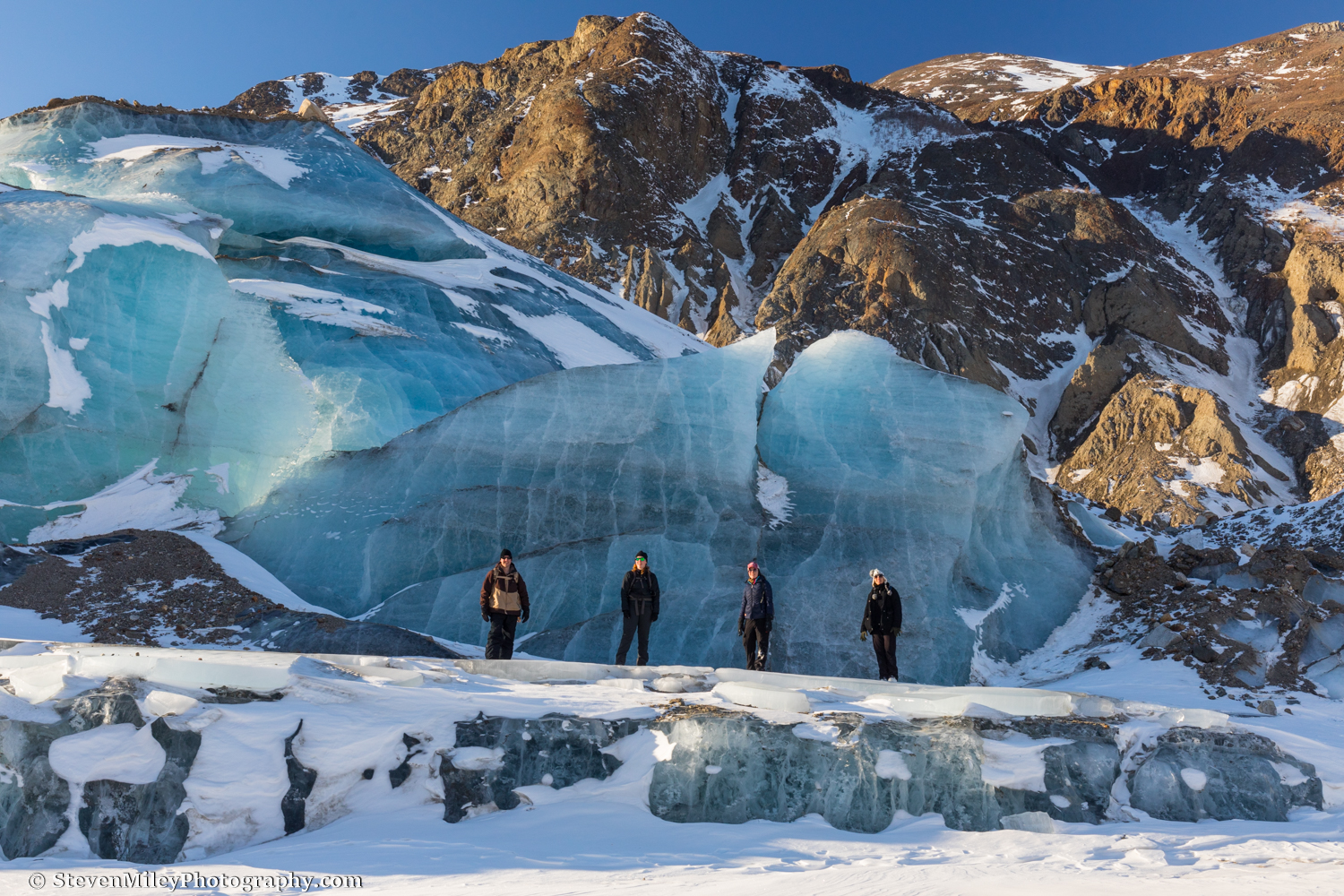
A sunny day at Black Rapids Glacier in early March.
I named my tours after Black Rapids Glacier, one of my favorite locations to photograph in Alaska. Guided tours of Black Rapids Glacier are only available when the Delta River is sufficiently frozen to permit safe crossing, typically from early January through late March. Unlike most other glaciers, Black Rapids accumulates little snow in the winter and features plenty of exposed ice near the front, so it’s very easy to find stunning features like ice caves, tunnels, arches, and more. Also, skis & snowshoes are usually not necessary to reach the glacier—just some traction devices for your boots. The total round trip distance to the glacier varies between 10-15 miles depending on how far you explore, which can be exhausting even for people in good shape because of the rugged terrain. So make sure you and everyone in your group can easily walk 10 miles in a day, and be prepared to battle the cold. Black Rapids Glacier is an authentic Interior Alaska backcountry adventure, don’t underestimate it!

Giant freestanding chunk of ice at Black Rapids Glacier.
Ice caves have become popular travel destinations over the past several years. Aside from Black Rapids Glacier, there’s generally one or more ice caves located at both Castner Glacier and Canwell Glacier. An easily reachable ice cave at the front of Castner Glacier has been around for a couple years now and hundreds, maybe thousands of people (mostly locals) visited it this winter, but I’ve been in several other ice caves at Castner Glacier that few or no other people have seen, many of which I liked better. In the summer, many ice caves become hazardous to enter and they change rapidly, so I recommend visiting them in winter. Most ice caves are located in very rugged terrain and require some strenuous up and down hiking or snowshoeing to reach, so a decent level of fitness and mobility is required. I provide snowshoes and traction devices at no extra charge if you don’t have your own. In winter you can also visit a frozen waterfall, go off grid to “No Name” Glacier or Fels Glacier, or ski/snowshoe/hike around the many other valleys and ridges in the area.

An ice cave in winter at Castner Glacier.
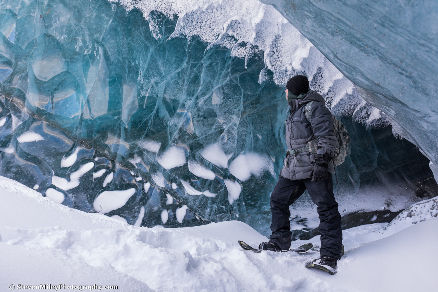
An ice cave in winter at Canwell Glacier.
In summer the Black Rapids area contains limitless hiking options, though people accustomed to hiking on marked and maintained trails will not find any of those here. There are trails, but you won’t find any trailhead signs, mileage markers, or even clear indications where the trails end. At best there will be a few pieces of trail tape or rock cairns to help you avoid wandering off course. And most of the trails end where the real fun of exploring alpine areas and glaciers begins. Off-trail hiking in the eastern Alaska Range can be extremely rewarding and as rugged as you desire. Boulder Peak, one of my favorite routes, is a great example: the route starts out with an easy walk up Boulder Creek, then ascends onto a gentle mountain slope where you can pick blueberries to your heart’s content and look for caribou, then climbs up a steep ridge to a minor peak with incredible views where most people would probably stop, but ultimately continues another 1500 vertical feet up to the summit of Boulder Peak just in case you weren’t exhausted already or somehow hadn’t spotted a Dall sheep yet. Beside Boulder Peak, you can easily wear yourself out on Grizzly Creek “Trail”, Michael Creek “Trail”, Whistler Ridge or Rainbow Ridge, which I listed in rough order of maximum potential difficulty, though all of these routes are moderate if you stick to a half-day hike or take an easier alternate route to their high points. If you’re looking for an easy day, consider Bear Creek “Trail” or choose from a variety of scenic mountain creeks to explore. Devils Thumb isn’t a terribly difficult hike, but it does gain a decent amount of elevation and you better be mentally prepared to bushwhack!
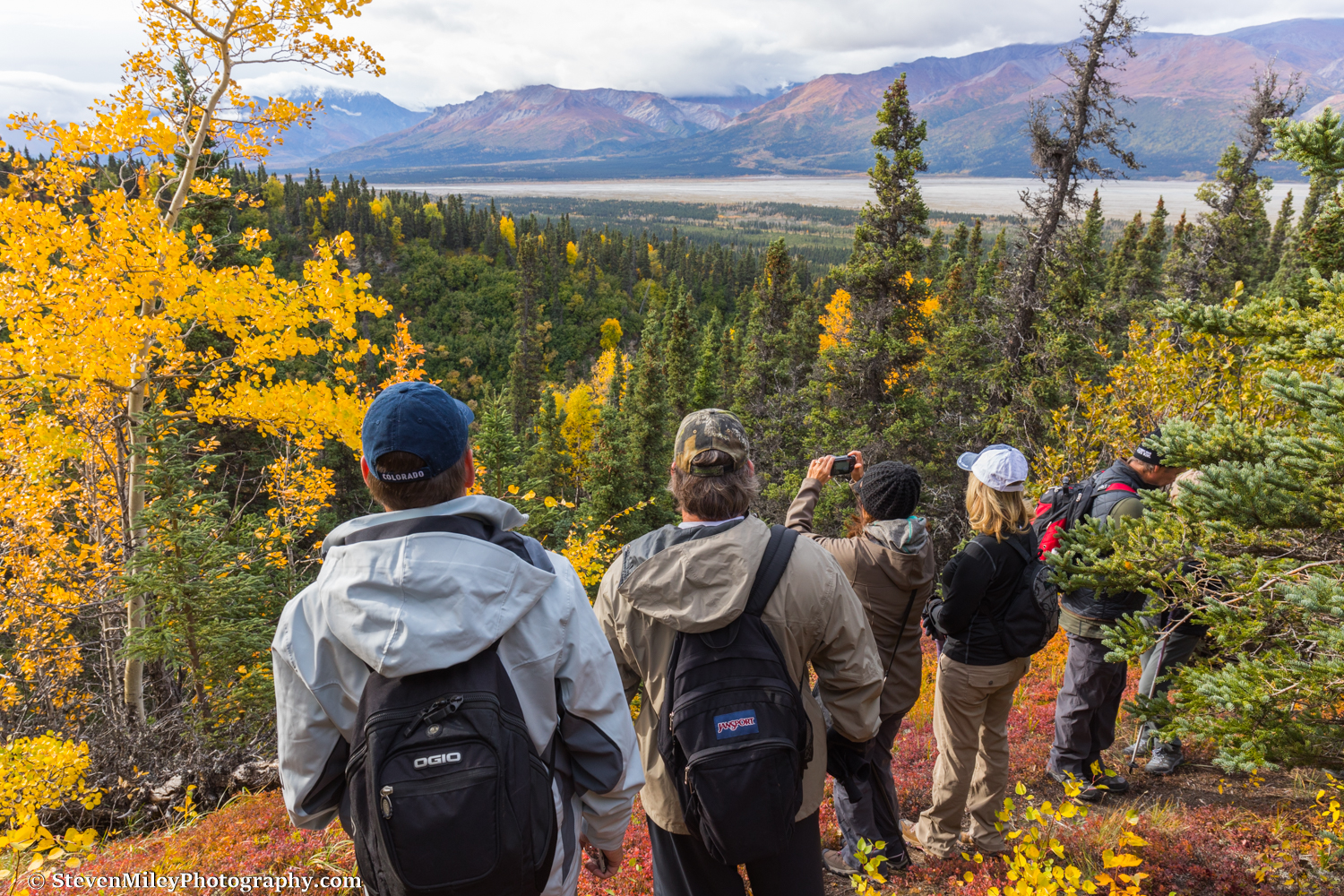
Hiking Bear Creek “Trail” in the fall.

Posing for an epic telephoto shot of McGinnis Peak and Mount Moffit from below the summit of Boulder Peak. Perspectives like this abound the Black Rapids area but most have never been photographed.

A half-day hike up Michael Creek “Trail” will get you to this wonderful alpine spot below this imposing rock outcropping.

A full-day hike up Michael Creek “Trail” goes beyond the rock outcropping in the previous image and high into the alpine. The route finishes with an impressive vista of Mount Silvertip (upper left) towering over Jarvis Glacier thousands of feet below.
Perhaps the best kept secrets of the eastern Alaska Range are the three road-accessible glaciers within 30 minutes of each other: Castner, Canwell, and Gulkana. Walking on the ice of Gulkana or Canwell Glacier is like walking on a 12-lane highway, whereas some touristy glaciers like Matanuska and Exit Glacier are full of seracs and crevasses that make them difficult to explore. Castner Glacier is covered in rock and more difficult to hike over but usually contains multiple ice caves scattered over the first mile or two of its length along with other spectacular sights. None of the glaciers require any sort of technical ice climbing gear to traverse, though I provide traction devices for extra stability. These glaciers are constantly changing in the summer as they melt, so there’s always something new and interesting to find.

A boulder impersonating a tombstone on Canwell Glacier.

Examining the floor of an ice cave at Castner Glacier in summer.
Come look for Dall sheep, caribou, eagles, moose, marmots, porcupines, bears, wolves, lynx, wolverines, and more in a place just as beautiful and wild as Denali National Park, but without the tourists. And do it at your own pace!


